The line is the official route from Natural England's National Trails (England) data (Open Government Licence v3.0), with heights from a 30 m terrain model. Check for current diversions before a long trip. See the source.
Stages
A suggested split into 13 days of about 23 km (14 mi) each. The days are equal shares of the distance, not official stages. Each ends near the town or village named.
- Day 1 St Bees to Ennerdale and Kinniside 23 km · 23 km from the start
- Day 2 Ennerdale and Kinniside to Borrowdale 23 km · 47 km from the start
- Day 3 Borrowdale to Patterdale 23 km · 70 km from the start
- Day 4 Patterdale to Shap Rural 23 km · 93 km from the start
- Day 5 Shap Rural to Crosby Garrett 23 km · 116 km from the start
- Day 6 Crosby Garrett to Muker 23 km · 140 km from the start
- Day 7 Muker to Reeth, Fremington and Healaugh 23 km · 163 km from the start
- Day 8 Reeth, Fremington and Healaugh to Brompton-on-Swale 23 km · 186 km from the start
- Day 9 Brompton-on-Swale to East Harlsey 23 km · 209 km from the start
- Day 10 East Harlsey to Swainby 23 km · 233 km from the start
- Day 11 Swainby to Farndale East 23 km · 256 km from the start
- Day 12 Farndale East to Grosmont 23 km · 279 km from the start
- Day 13 Grosmont to Fylingdales 23 km · 302 km from the start
Summits on the way
- Grey Knotts 697 m · 41 km from the start
- Angletarn Pikes [Angletarn Pikes North Top] 566 m · 74 km from the start
- Angletarn Pikes South Top 564 m · 74 km from the start
- Buck Crag 570 m · 75 km from the start
- Satura Crag 569 m · 76 km from the start
- The Knott (High Street) 739 m · 78 km from the start
- Rampsgill Head 792 m · 79 km from the start
- Kidsty Pike 781 m · 79 km from the start
- Nine Standards Rigg 662 m · 134 km from the start
- White Mossy Hill 660 m · 135 km from the start
The listed hills and the highest of 35 tops within 300 m of the line. The app shows them all. Lists from the Database of British and Irish Hills; other summits from OpenStreetMap.
Start and finish
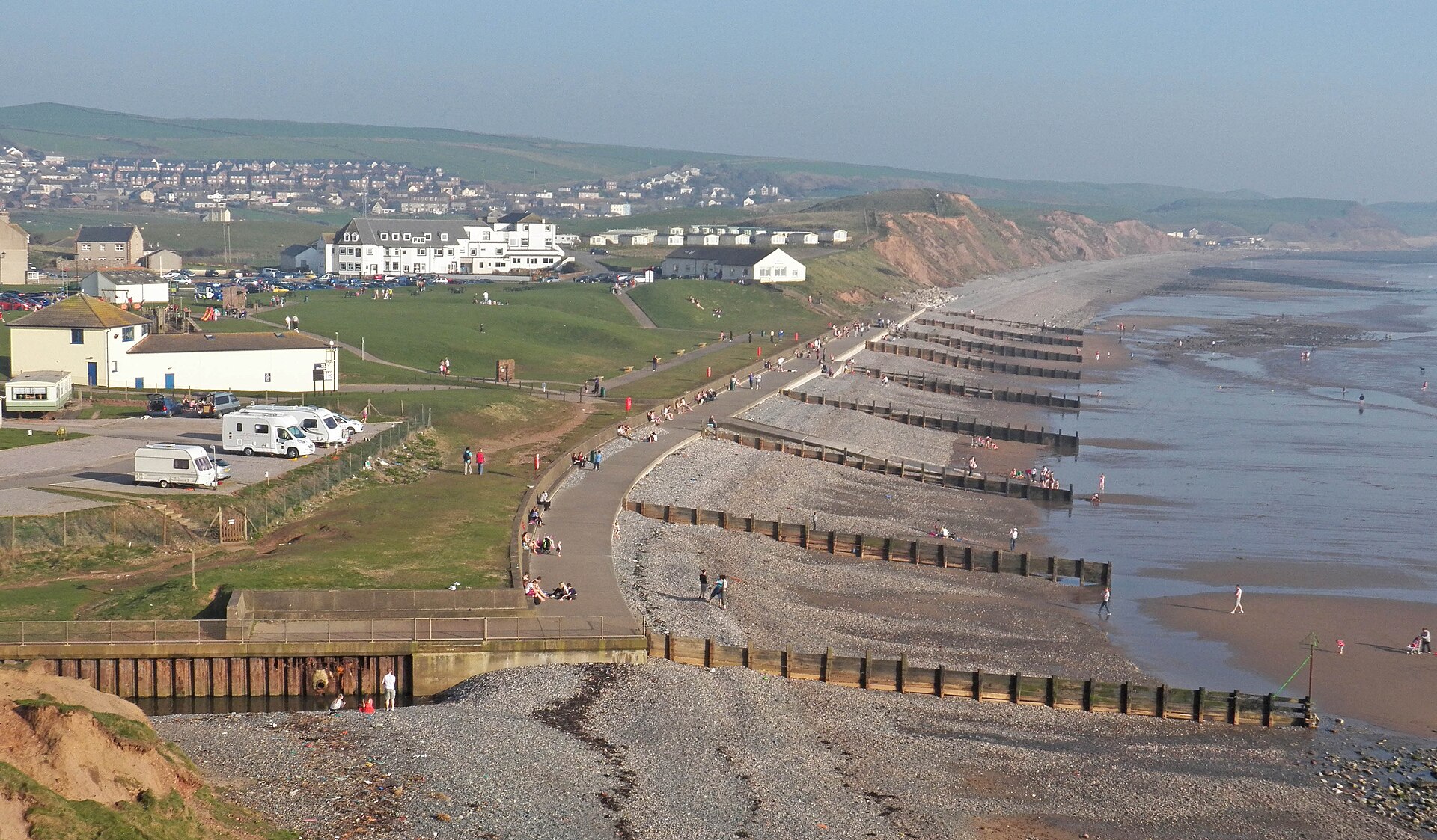
Start: near St Bees, Cumberland. 54.49071, -3.60400
Finish: near Fylingdales, North Yorkshire. 54.43034, -0.53203
Places to stay
Rooms in the towns and villages along the way:
- St Bees, Cumberland · The start Booking.com → Expedia →
- Ennerdale and Kinniside, Cumberland · After day 1 Booking.com → Expedia →
- Borrowdale, Cumberland · After day 2 Booking.com → Expedia →
- Patterdale, Westmorland and Furness · After day 3 Booking.com → Expedia →
- Shap Rural, Westmorland and Furness · After day 4 Booking.com → Expedia →
- Crosby Garrett, Westmorland and Furness · After day 5 Booking.com → Expedia →
- Muker, North Yorkshire · After day 6 Booking.com → Expedia →
- Reeth, Fremington and Healaugh, North Yorkshire · After day 7 Booking.com → Expedia →
- Brompton-on-Swale, North Yorkshire · After day 8 Booking.com → Expedia →
- East Harlsey, North Yorkshire · After day 9 Booking.com → Expedia →
- Swainby, North Yorkshire · After day 10 Booking.com → Expedia →
- Farndale East, North Yorkshire · After day 11 Booking.com → Expedia →
- Grosmont, North Yorkshire · After day 12 Booking.com → Expedia →
- Fylingdales, North Yorkshire · The finish Booking.com → Expedia →
Affiliate links: if you book, Global Adventurer earns a small commission at no cost to you.
Paths change, and the weather decides the day. The line comes from the source named under the map and the heights from a terrain model, so treat the figures as a guide. Check for diversions before you go, take a map, check the forecast, and turn back if it isn't right.


