Line © OpenStreetMap contributors (ODbL), checked by Global Adventurer.
The walk
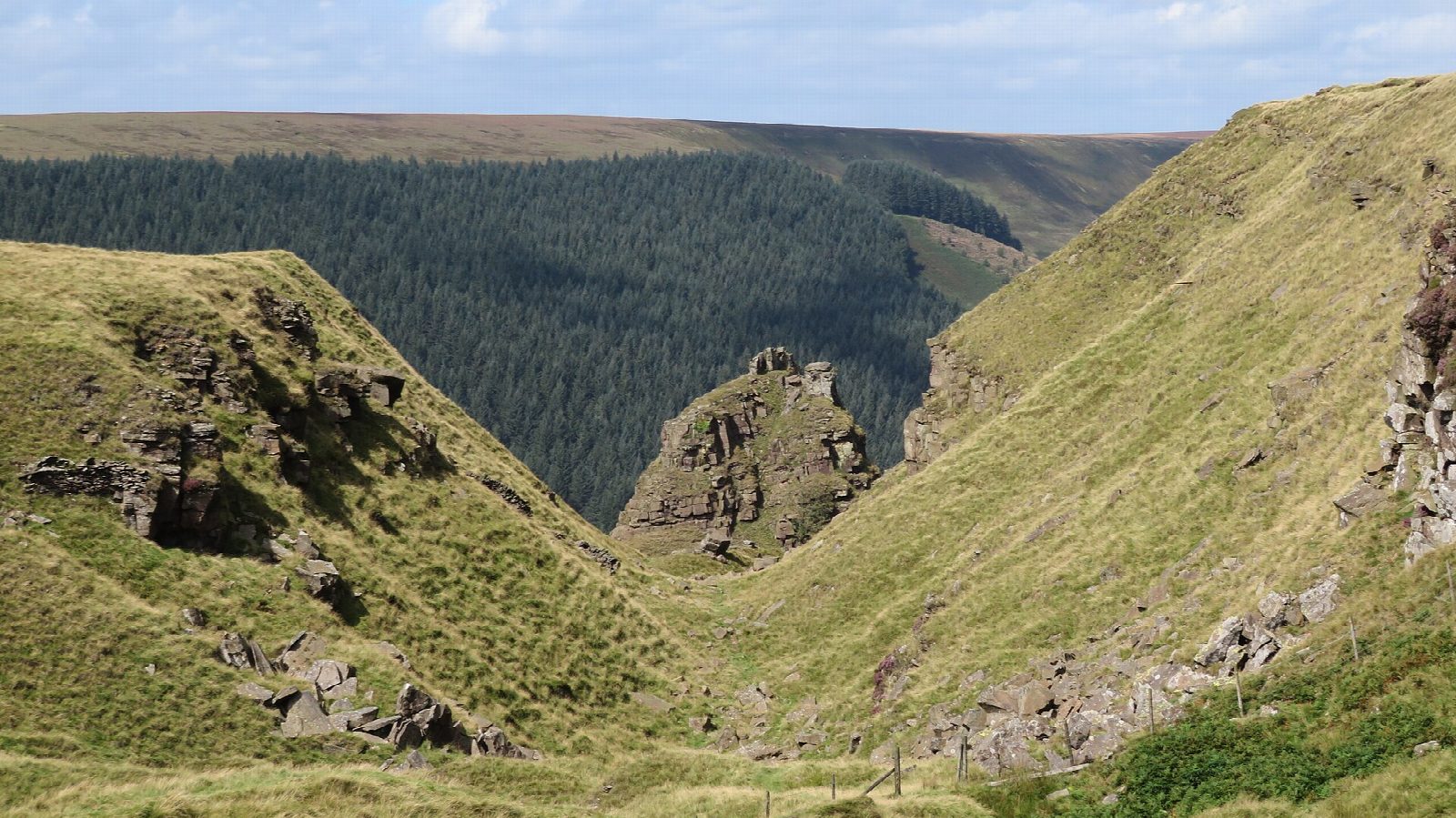
The walk starts from the Fairholmes car park below Derwent Dam. A path climbs through the woods to the ridge above Lockerbrook, and a clear path, flagged in places, runs north-west along Rowlee Pasture to the edge above Alport Castles, where a landslip more than half a mile long has left the Tower standing apart from the hillside. The route follows the edge north, drops east down Ditch Clough through the plantations to the western arm of Howden Reservoir, and returns along the reservoir road past Howden Dam and Derwent Reservoir.
It is 12.7 km with 285 m of ascent; allow about 4 hours. The grade is Moderate.
Rowlee Pasture is open moor, boggy between the flagstones, and the edge at Alport Castles is unfenced and crumbling: keep back from it. The last third is on the tarmac reservoir road, which is closed to traffic every Sunday, and on Saturdays and bank holidays from Easter to the end of October; on other days expect a few cars. Severn Trent asks for dogs to be on a lead. Forestry work sometimes closes paths in these woods, so look for notices at Fairholmes.
The car park charges, and has toilets and a café. There is no station nearby.
Route drawn by Global Adventurer along OpenStreetMap paths (© OpenStreetMap contributors, ODbL), with figures worked out from it. Check the forecast and the ground on the day: paths change.
Good to know
- Alport Castles is a landslip more than half a mile long, thought to be the largest in Britain
- The Tower is a mass of gritstone that has slipped away from the hillside
- Starts below Derwent Dam and returns beside Howden and Derwent reservoirs
- The reservoir road is closed to traffic on Sundays, and on Saturdays and bank holidays from Easter to the end of October
Getting there
Start: Fairholmes car park · Pay and display. 53.40056, -1.74133
Places to stay nearby
Rooms in and around Hope: Booking.com → Expedia →
Affiliate links: if you book, Global Adventurer earns a small commission at no cost to you.
Paths change, and the weather decides the day. The line and figures come from OpenStreetMap and our own checks; take a map, check the forecast, and turn back if it isn't right.


