Line © OpenStreetMap contributors (ODbL), checked by Global Adventurer.
The walk
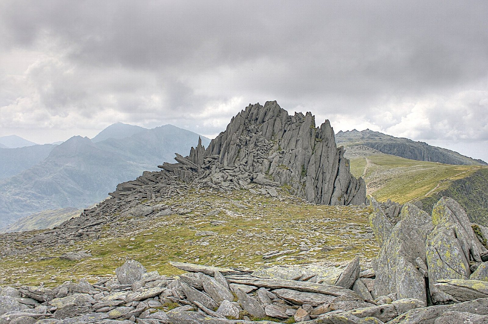
The walk makes a circuit from the car park at Ogwen. It climbs past Llyn Bochlwyd to Bwlch Tryfan and takes the Miners' Track onto the plateau; Bristly Ridge is a scramble and not part of this route. It crosses two summits of shattered rock: Glyder Fach (994 m), with the Cantilever Stone and Castell y Gwynt, and Glyder Fawr (1,001 m). The descent is by Llyn y Cwn and the Devil's Kitchen path under Twll Du to Llyn Idwal, in Cwm Idwal, the first National Nature Reserve in Wales.
It is 10.7 km with 835 m of ascent; allow about 6 hours. The grade is Hard: the tops are boulder and scree, and the Devil's Kitchen path is a steep, rocky descent.
The plateau is confusing in mist, so carry a map and compass, check the mountain forecast and use your judgement. In winter the plateau and the Devil's Kitchen hold snow and ice and need an ice axe, crampons and experience.
The car park charges a fee. Roman Bridge station is about 11 km away in a straight line. There are no mapped water sources on the route.
Route drawn by Global Adventurer along OpenStreetMap paths (© OpenStreetMap contributors, ODbL), with figures worked out from it. Check the forecast and the ground on the day: paths change.
Good to know
- Two 1000 m summits of shattered rock: the Cantilever Stone and Castell y Gwynt are on Glyder Fach
- Up by Llyn Bochlwyd, Bwlch Tryfan and the Miners' Track; Bristly Ridge is a scramble and not part of this route
- Down by Llyn y Cwn and the Devil's Kitchen path to Llyn Idwal
- Cwm Idwal was the first National Nature Reserve in Wales
Summits on the way
- Glyder Fach 994 m
- Castell y Gwynt 972 m · passed close by
- Glyder Fawr 1,001 m
Getting there
Start: Ogwen · Pay and display. 53.12380, -4.02041
Places to stay nearby
Rooms in and around Roman Bridge: Booking.com → Expedia →
Affiliate links: if you book, Global Adventurer earns a small commission at no cost to you.
Paths change, and the weather decides the day. The line and figures come from OpenStreetMap and our own checks; take a map, check the forecast, and turn back if it isn't right.


