Line © OpenStreetMap contributors (ODbL), checked by Global Adventurer.
The walk
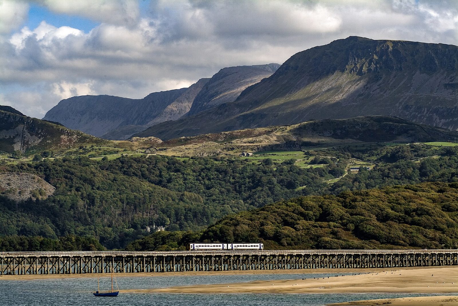
The walk starts from the main car park in Barmouth, by the station. It follows the seafront and harbour to Barmouth Bridge and crosses the estuary on the footway beside the railway, 820 m of wooden viaduct. At the far end it turns left along the shore, round the rocky knoll of Fegla Fawr, and follows the edge of the saltmarsh to Arthog. There it joins the Mawddach Trail, the bed of the old railway to Dolgellau, and turns back west to Morfa Mawddach station. The trail leads on to the bridge, and the way back to Barmouth is over it again.
It is 8.0 km with 36 m of ascent; allow about 2 hours. The grade is Easy.
The walk is flat. The Mawddach Trail is shared with cyclists, and sand can blow onto the path at the Barmouth end of the bridge. The shore path round Fegla Fawr is rougher and can be wet. The bridge has an honesty box for a voluntary toll. It was closed for long spells during its restoration, which finished in December 2023; no closure was announced for this autumn when we checked.
The car park charges. There are stations at both ends of the bridge, Barmouth and Morfa Mawddach, on the Cambrian Coast line, and a free National Park car park at Morfa Mawddach.
Route drawn by Global Adventurer along OpenStreetMap paths (© OpenStreetMap contributors, ODbL), with figures worked out from it. Check the forecast and the ground on the day: paths change.
Good to know
- Barmouth Bridge is a wooden railway viaduct 820 m long, opened in 1867, with a footway beside the track
- Round the rocky knoll of Fegla Fawr on the shore of the estuary
- Back along the Mawddach Trail, the bed of a railway that closed in 1965
- Stations at both ends of the bridge: Barmouth and Morfa Mawddach
Getting there
Start: Barmouth main car park · Pay and display. 52.72036, -4.05439
By train: Barmouth station is 0.3 km from the start.
Places to stay nearby
Rooms in and around Barmouth: Booking.com → Expedia →
Affiliate links: if you book, Global Adventurer earns a small commission at no cost to you.
Paths change, and the weather decides the day. The line and figures come from OpenStreetMap and our own checks; take a map, check the forecast, and turn back if it isn't right.

