The line is OpenStreetMap's mapping of the route (© OpenStreetMap contributors, ODbL), via Waymarked Trails, with heights from a 30 m terrain model. Check the current official route before a long trip: diversions and permitted paths change. See the source.
The trail
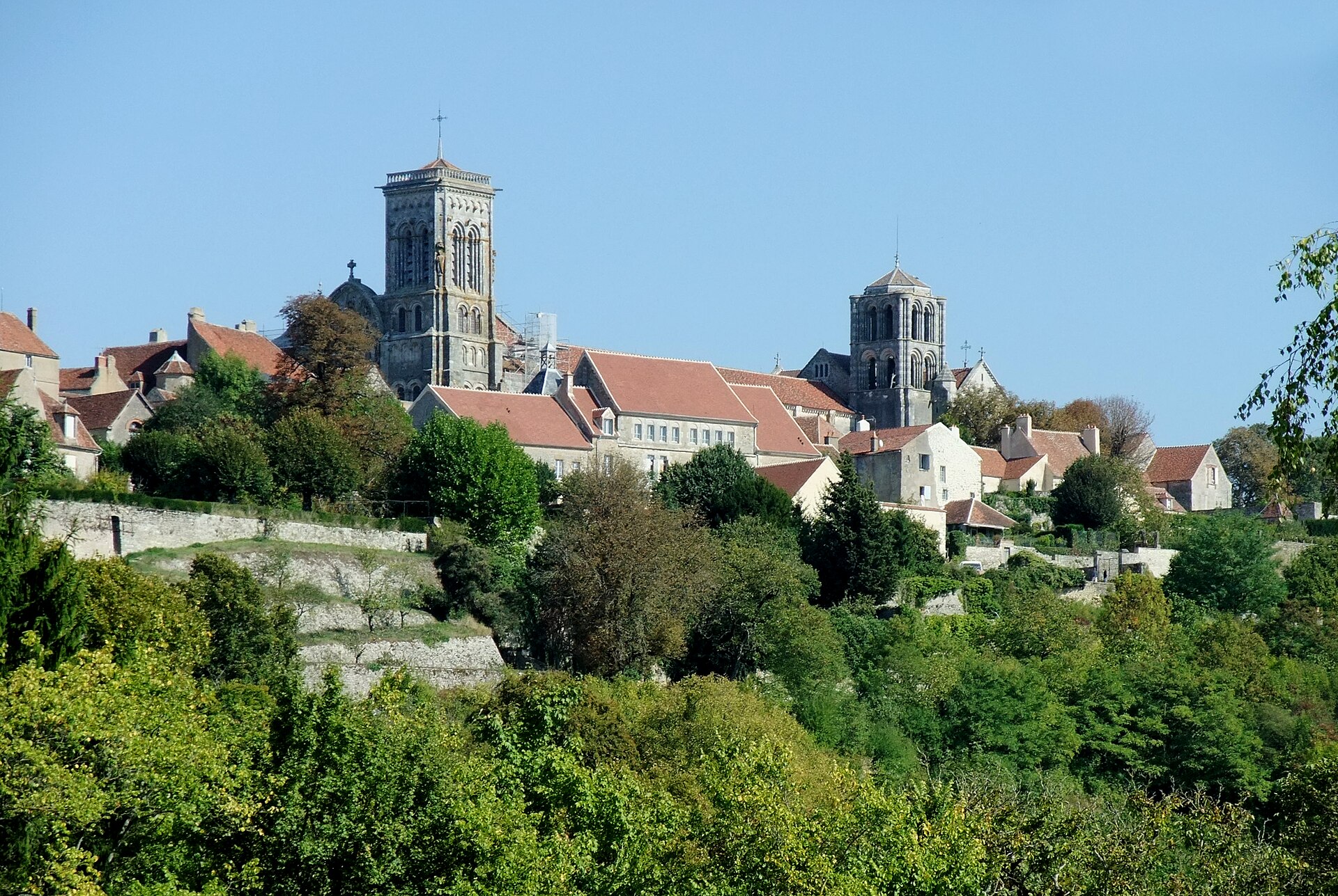
The Vézelay way by Bourges, Limoges and Périgueux to the meeting of the French ways near Ostabat, then on the GR 65 to Saint-Jean-Pied-de-Port; for the Compostela the walk continues into Santiago.
Map sections
About 37 days at about 24 km (15 mi) a day, an estimate from the length. Too many to list day by day, so here the line is in 30 sections, each ending at a town or village it passes, to help you find your way along it. They are not daily stages, and they vary from 25 km to 36 km: plan your days and nights from the trail's own guide.
- Section 1 Vézelay to Cuncy-lès-Varzy 30 km · 30 km from the start
- Section 2 Cuncy-lès-Varzy to Arbourse 30 km · 60 km from the start
- Section 3 Arbourse to Sancergues 30 km · 90 km from the start
- Section 4 Sancergues to Brécy 31 km · 121 km from the start
- Section 5 Brécy to La Chapelle-Saint-Ursin 29 km · 150 km from the start
- Section 6 La Chapelle-Saint-Ursin to Issoudun 33 km · 182 km from the start
- Section 7 Issoudun to Châteauroux 35 km · 218 km from the start
- Section 8 Châteauroux to Saint-Marcel 36 km · 254 km from the start
- Section 9 Saint-Marcel to Éguzon-Chantôme 26 km · 280 km from the start
- Section 10 Éguzon-Chantôme to La Souterraine 33 km · 312 km from the start
- Section 11 La Souterraine to Arrènes 29 km · 342 km from the start
- Section 12 Arrènes to Le Châtenet-en-Dognon 30 km · 372 km from the start
- Section 13 Le Châtenet-en-Dognon to Feytiat 27 km · 399 km from the start
- Section 14 Feytiat to Saint-Martin-le-Vieux 28 km · 427 km from the start
- Section 15 Saint-Martin-le-Vieux to Firbeix 27 km · 454 km from the start
- Section 16 Firbeix to Thiviers 28 km · 481 km from the start
- Section 17 Thiviers to Fontnovias 25 km · 506 km from the start
- Section 18 Fontnovias to Annesse-et-Beaulieu 32 km · 538 km from the start
- Section 19 Annesse-et-Beaulieu to Saint-Louis-en-l'Isle 29 km · 566 km from the start
- Section 20 Saint-Louis-en-l'Isle to Monfaucon 28 km · 594 km from the start
- Section 21 Monfaucon to Pellegrue 33 km · 627 km from the start
- Section 22 Pellegrue to La Réole 27 km · 655 km from the start
- Section 23 La Réole to Brouqueyran 26 km · 681 km from the start
- Section 24 Brouqueyran to Captieux 29 km · 710 km from the start
- Section 25 Captieux to Retjons 25 km · 734 km from the start
- Section 26 Retjons to Bougue 30 km · 765 km from the start
- Section 27 Bougue to Saint-Sever 30 km · 795 km from the start
- Section 28 Saint-Sever to Argelos 25 km · 820 km from the start
- Section 29 Argelos to L'Hôpital-d'Orion 29 km · 849 km from the start
- Section 30 L'Hôpital-d'Orion to Elhordoï 30 km · 880 km from the start
Start and finish
Start: near Vézelay, Yonne. 47.46603, 3.74713
Finish: near Elhordoï, Pyrénées-Atlantiques. 43.29898, -1.03479
Places to stay
Rooms in the towns and villages along the way:
- Vézelay, Yonne · The start Booking.com → Expedia →
- Cuncy-lès-Varzy, Nièvre · 30 km from the start Booking.com → Expedia →
- Arbourse, Nièvre · 60 km from the start Booking.com → Expedia →
- Sancergues, Cher · 90 km from the start Booking.com → Expedia →
- Brécy, Cher · 121 km from the start Booking.com → Expedia →
- La Chapelle-Saint-Ursin, Cher · 150 km from the start Booking.com → Expedia →
- Issoudun, Indre · 182 km from the start Booking.com → Expedia →
- Châteauroux, Indre · 218 km from the start Booking.com → Expedia →
- Saint-Marcel, Indre · 254 km from the start Booking.com → Expedia →
- Éguzon-Chantôme, Indre · 280 km from the start Booking.com → Expedia →
- La Souterraine, Creuse · 312 km from the start Booking.com → Expedia →
- Arrènes, Creuse · 342 km from the start Booking.com → Expedia →
- Le Châtenet-en-Dognon, Haute-Vienne · 372 km from the start Booking.com → Expedia →
- Feytiat, Haute-Vienne · 399 km from the start Booking.com → Expedia →
- Saint-Martin-le-Vieux, Haute-Vienne · 427 km from the start Booking.com → Expedia →
- Firbeix, Dordogne · 454 km from the start Booking.com → Expedia →
- Thiviers, Dordogne · 481 km from the start Booking.com → Expedia →
- Fontnovias, Dordogne · 506 km from the start Booking.com → Expedia →
- Annesse-et-Beaulieu, Dordogne · 538 km from the start Booking.com → Expedia →
- Saint-Louis-en-l'Isle, Dordogne · 566 km from the start Booking.com → Expedia →
- Monfaucon, Dordogne · 594 km from the start Booking.com → Expedia →
- Pellegrue, Gironde · 627 km from the start Booking.com → Expedia →
- La Réole, Gironde · 655 km from the start Booking.com → Expedia →
- Brouqueyran, Gironde · 681 km from the start Booking.com → Expedia →
- Captieux, Gironde · 710 km from the start Booking.com → Expedia →
- Retjons, Landes · 734 km from the start Booking.com → Expedia →
- Bougue, Landes · 765 km from the start Booking.com → Expedia →
- Saint-Sever, Landes · 795 km from the start Booking.com → Expedia →
- Argelos, Landes · 820 km from the start Booking.com → Expedia →
- L'Hôpital-d'Orion, Pyrénées-Atlantiques · 849 km from the start Booking.com → Expedia →
- Elhordoï, Pyrénées-Atlantiques · The finish Booking.com → Expedia →
Affiliate links: if you book, Global Adventurer earns a small commission at no cost to you.
Paths change, and the weather decides the day. The line comes from the source named under the map and the heights from a terrain model, so treat the figures as a guide. Check for diversions before you go, take a map, check the forecast, and turn back if it isn't right.


