Line © OpenStreetMap contributors (ODbL), checked by Global Adventurer.
The walk
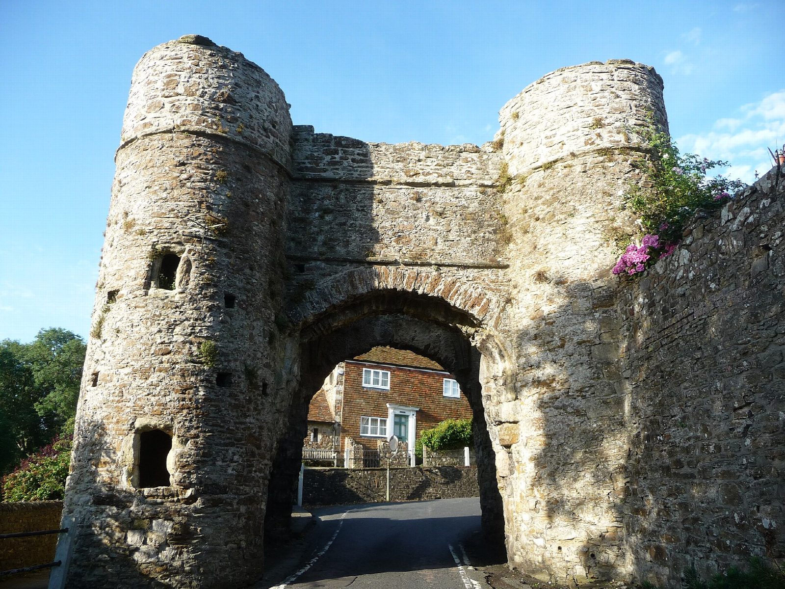
From Rye station the walk goes down to the windmill and Gibbet Marsh, where the 1066 Country Walk leaves the town. It follows the walk's bridleway west along the foot of Cadborough Cliffs, with the levels of the River Brede on the left, then climbs to Dumb Woman's Lane and follows lanes south past Winchelsea station and over Ferry Bridge. A footpath climbs to the town, laid out for Edward I about 1300, and the walk goes through its streets, past St Thomas's church, to the Strand Gate, with its view over the marsh to the sea. It comes back down to Ferry Bridge and returns to Rye by field paths across the levels.
It is 10.9 km with 38 m of ascent; allow about 3 hours. The grade is Easy: nearly level, with short climbs at Dumb Woman's Lane and into Winchelsea.
About a third is on lanes and streets, some without pavements. The field paths over the levels can be wet, and in crops you may prefer the field edges. Sheep and cattle graze the marsh, so keep dogs on leads. Winchelsea station, passed after about 4 km, has fewer trains than Rye and no ticket machine: check times if you want to cut the walk short there.
Rye station car park is a pay car park with about 98 spaces. Rye station is at the start.
Route drawn by Global Adventurer along OpenStreetMap paths (© OpenStreetMap contributors, ODbL), with figures worked out from it. Check the forecast and the ground on the day: paths change.
Good to know
- From Rye along the 1066 Country Walk, under Cadborough Cliffs and by Dumb Woman's Lane to Winchelsea
- Through Winchelsea, a town laid out for Edward I about 1300, to the Strand Gate and past St Thomas's church
- Back to Rye across the levels of the River Brede on public footpaths
- Winchelsea station, passed on the way out, has fewer trains than Rye
Getting there
Start: Rye station · Pay and display. 50.95263, 0.73102
By train: Rye station is 0.0 km from the start.
Places to stay nearby
Rooms in and around Rye: Booking.com → Expedia →
Affiliate links: if you book, Global Adventurer earns a small commission at no cost to you.
Paths change, and the weather decides the day. The line and figures come from OpenStreetMap and our own checks; take a map, check the forecast, and turn back if it isn't right.


