Line © OpenStreetMap contributors (ODbL), checked by Global Adventurer.
The walk
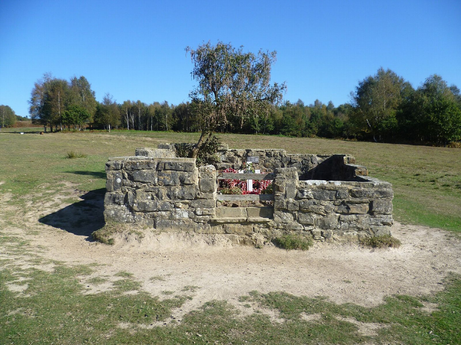
From Hollies car park the walk goes past the information board and downhill, due south, on a wide grassy track over the heath. After about 1 km of descent, steep in places, it reaches the walled enclosure of the Airman's Grave. Nobody is buried here: it is a memorial to the six crew of a Wellington bomber that crashed on this slope on 31 July 1941, coming back from a raid on Cologne. The track goes on down to a stream, turns right over the bridge and climbs out of the gully, then bears right at the brow and rises steadily for about 1 km. Near Stonehill car park it turns right onto another wide track and runs back to Hollies, with Camp Hill Clump on the skyline ahead.
It is 3.1 km with 82 m of ascent; allow about 1 hour. The grade is Easy: short, but all the climbing comes at the end.
Commoners' sheep and cattle graze this side of the Forest from spring to autumn, so keep dogs under control, and on the paths from 1 March to 31 August. The tracks are rough and are muddy after rain. On a clear day the view runs to the South Downs.
Ashdown Forest car parks charge: £2 for an hour, £2.50 for two, paid by phone or app. There is no station near.
Route drawn by Global Adventurer along OpenStreetMap paths (© OpenStreetMap contributors, ODbL), with figures worked out from it. Check the forecast and the ground on the day: paths change.
Good to know
- Down the open heath from Hollies to the Airman's Grave, a walled memorial to the six crew of a Wellington bomber that crashed here on 31 July 1941
- Nobody is buried there; a service is held every year
- Over the stream and back up the far side of the valley, with views to the South Downs
- Commoners' cattle and sheep graze this side of the Forest from spring to autumn
Getting there
Start: Hollies car park · Pay and display. 51.03856, 0.08348
Places to stay nearby
Rooms in and around Buxted: Booking.com → Expedia →
Affiliate links: if you book, Global Adventurer earns a small commission at no cost to you.
Paths change, and the weather decides the day. The line and figures come from OpenStreetMap and our own checks; take a map, check the forecast, and turn back if it isn't right.