Line © OpenStreetMap contributors (ODbL), checked by Global Adventurer.
The walk
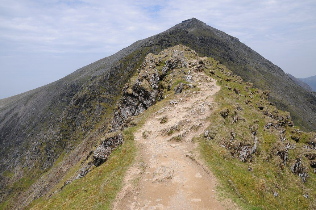
The walk starts from the Rhyd Ddu car park beside the Welsh Highland Railway station. From the far end of the car park it crosses the railway and follows a track past the old Ffridd slate quarry, then turns off left at a standing stone and gate. The path climbs rough pasture, steepening to the shoulder of the Llechog ridge, and follows the rim of Cwm Clogwyn before zigzagging up to Bwlch Main. A narrow ridge leads on, joined by the South Ridge path and then the Watkin Path, to a last rocky climb to the summit of Yr Wyddfa. The return is the same way.
It is 12.0 km with 894 m of ascent; allow about 6¼ hours. The grade is Hard, for the length, the climb and the rough upper ground.
At the top of the zigzags the path becomes very narrow with a steep slope below, and Bwlch Main is exposed to the wind. In snow and ice the final section is only for experienced walkers with the right equipment. On the way down, bear right where the South Ridge path leaves. The summit café, Hafod Eryri, opens only in the season and when trains are running.
The car park is pay and display, card only, and can be full early in summer. The Sherpa'r Wyddfa S3 bus from Caernarfon stops at the station.
Route drawn by Global Adventurer along OpenStreetMap paths (© OpenStreetMap contributors, ODbL), with figures worked out from it. Check the forecast and the ground on the day: paths change.
Good to know
- One of the quieter paths up Yr Wyddfa, from the west
- Passes the remains of the Ffridd slate quarry low down
- Finishes along Bwlch Main, 'the Saddle', a narrow ridge with steep slopes on both sides
- The car park is at Rhyd Ddu station on the Welsh Highland Railway
Summits on the way
- Llechog 700 m · passed close by
- Clawdd Coch 931 m · passed close by
- Snowdon - Yr Wyddfa 1,085 m
Getting there
Start: Rhyd Ddu car park · Pay and display. 53.05109, -4.13339
Places to stay nearby
Rooms in and around Porthmadog: Booking.com → Expedia →
Affiliate links: if you book, Global Adventurer earns a small commission at no cost to you.
Paths change, and the weather decides the day. The line and figures come from OpenStreetMap and our own checks; take a map, check the forecast, and turn back if it isn't right.

