Line © OpenStreetMap contributors (ODbL), checked by Global Adventurer.
The walk
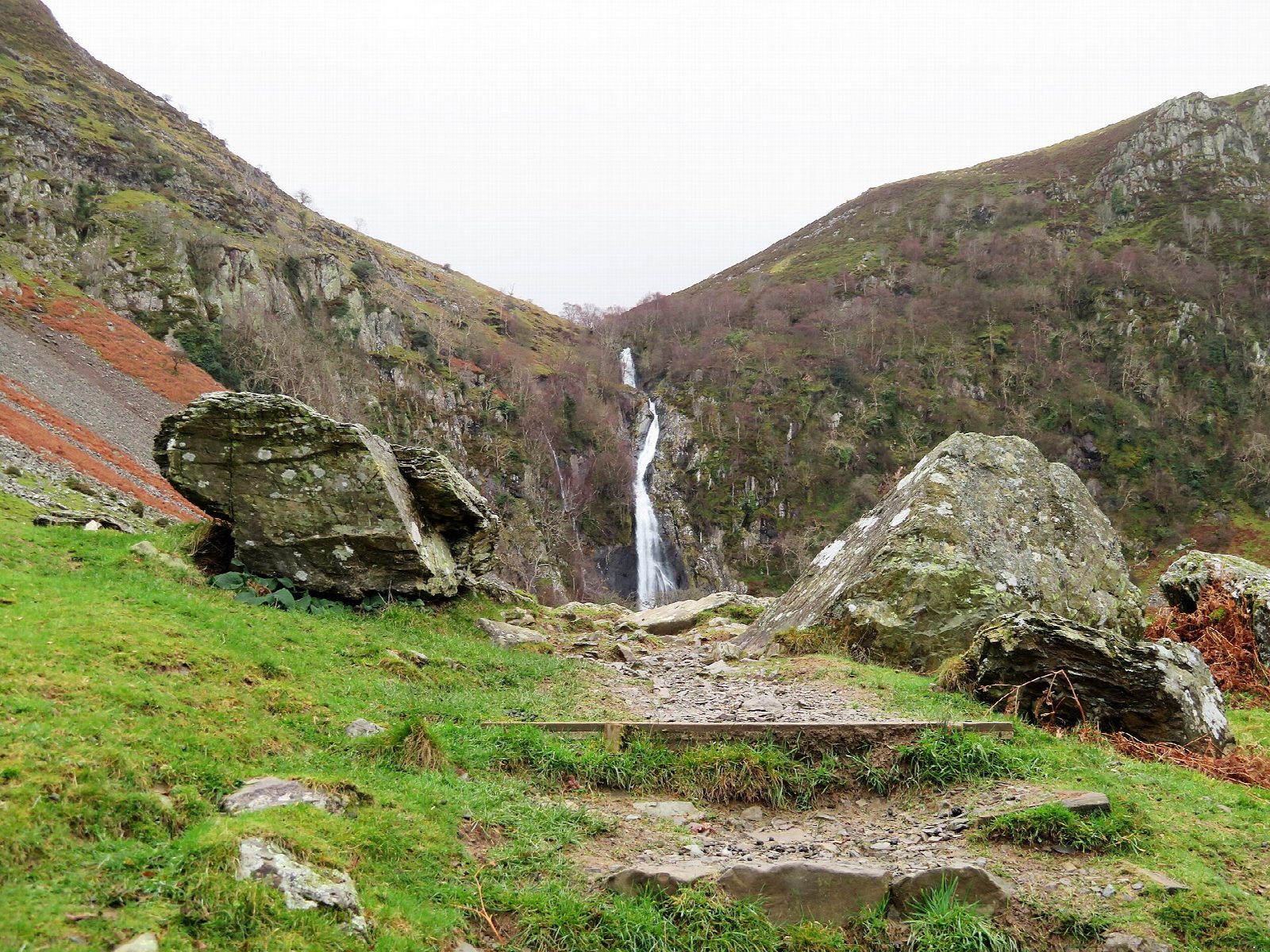
The walk starts from the car park at Bont Newydd, above Abergwyngregyn. Go through the gate and follow the wide track up the valley of the Afon Rhaeadr Fawr, past the remains of an Iron Age roundhouse, to the foot of Rhaeadr Fawr, where the Afon Goch drops about 37 m over a sill of hard rock. Cross the footbridge below the falls and follow the North Wales Path west, over the streams that come down from Rhaeadr Bach. The path then runs north along the open hillside above the valley and drops by a steep, stepped path to the lane, which leads back up to Bont Newydd.
It is 6.6 km with 226 m of ascent; allow about 2¼ hours. The grade is Easy.
The return is rougher than the track to the falls: there are several streams to cross, and the steep descent is awkward when wet. There are unprotected drops at the waterfalls, and the rocks below them are slippery.
Parking at Bont Newydd costs £5, and the two small car parks fill quickly at weekends; a free car park lies on the edge of the village, about a mile below. The gate of the upper car park is locked each evening, at 5pm from October to March. Buses between Bangor and Llandudno stop in the village. Llanfairfechan station is about 5 km away.
Route drawn by Global Adventurer along OpenStreetMap paths (© OpenStreetMap contributors, ODbL), with figures worked out from it. Check the forecast and the ground on the day: paths change.
Good to know
- Rhaeadr Fawr, the big waterfall: the Afon Goch drops about 37 m over a sill of hard rock
- The valley woods are the Coedydd Aber National Nature Reserve
- The remains of an Iron Age roundhouse lie beside the track
- Abergwyngregyn was a home of Llywelyn ap Gruffudd, the last prince of Wales before the conquest of 1282
Getting there
Start: Bont Newydd car park, Abergwyngregyn · Pay and display. 53.22829, -4.00538
Places to stay nearby
Rooms in and around Bont Newydd car park: Booking.com → Expedia →
Affiliate links: if you book, Global Adventurer earns a small commission at no cost to you.
Paths change, and the weather decides the day. The line and figures come from OpenStreetMap and our own checks; take a map, check the forecast, and turn back if it isn't right.

