Line © OpenStreetMap contributors (ODbL), checked by Global Adventurer.
The walk
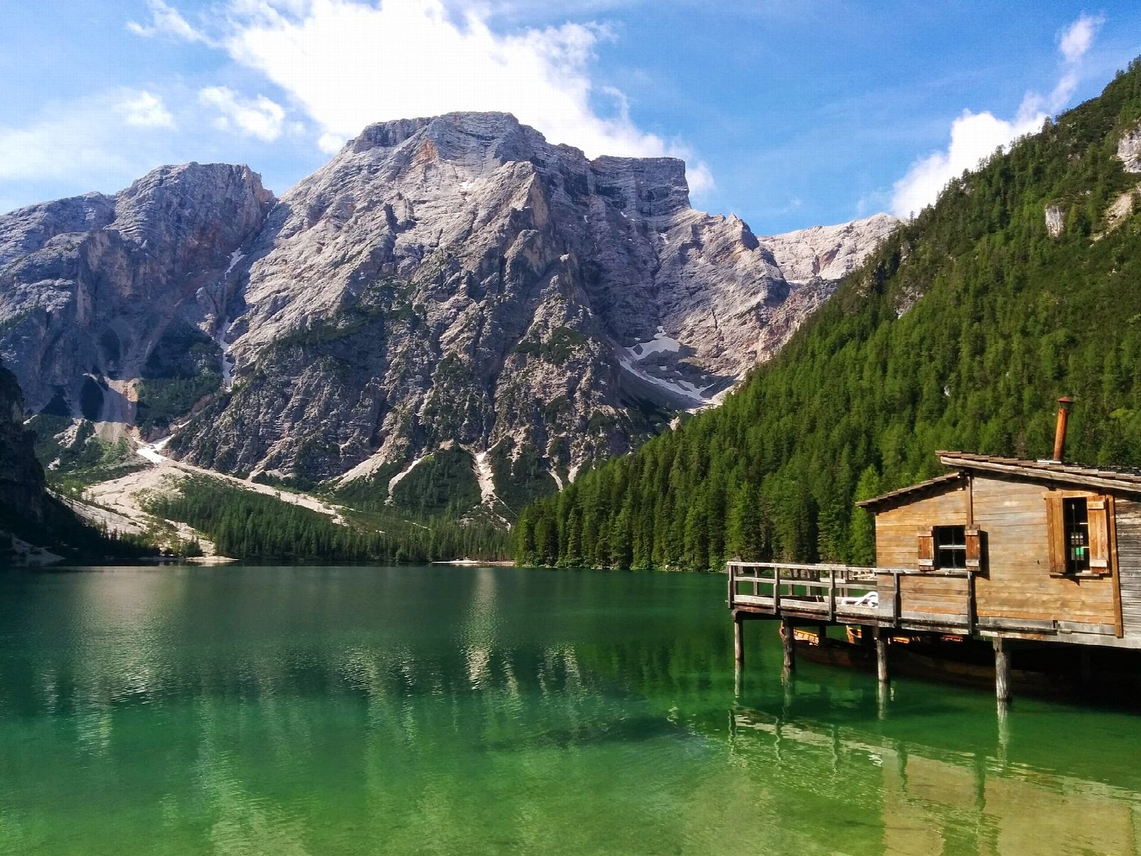
From car park P4, about 100 m from the water, walk down to the Hotel Lago di Braies and the wooden boathouse on the north shore. Going clockwise, the path follows the east shore through the woods, with a stepped section on the way, to the head of the lake below the Croda del Becco (Seekofel), about 2,800 m. It returns along the west shore and past the small chapel, built in 1904, to the hotel and the car park.
It is 3.8 km round with 76 m of ascent; allow about an hour. The grade is Easy: a good path all the way, with some steps and short climbs.
The lake lies at about 1,500 m in the Fanes-Senes-Braies nature park and is one of the busiest places in the Dolomites in summer, so access is controlled. From 1 July to 15 September (2026 dates), between 9:00 and 16:00, cars may drive up only with an online booking, and the buses from Dobbiaco, Villabassa and Monguelfo must also be booked. Outside those dates there are no restrictions, and the tourist board says the walk can be done all year.
Car park P4 is the nearest to the lake; P3 and P2 are further down the valley, 300 and 800 m away. All of them are paid.
Route drawn by Global Adventurer along OpenStreetMap paths (© OpenStreetMap contributors, ODbL), with figures worked out from it. Check the forecast and the ground on the day: paths change.
Good to know
- A lake at about 1,500 m under the walls of the Croda del Becco (Seekofel), in the Fanes-Senes-Braies nature park
- The wooden boathouse and its rowing boats are the lake's famous view
- The lakeside chapel was built in 1904
- From 1 July to 15 September cars need a booking to drive up between 9:00 and 16:00
Getting there
Start: Lago di Braies car park P4 · Pay and display. 46.70039, 12.08470
Places to stay nearby
Rooms in and around Dolomites: Booking.com → Expedia →
Affiliate links: if you book, Global Adventurer earns a small commission at no cost to you.
Paths change, and the weather decides the day. The line and figures come from OpenStreetMap and our own checks; take a map, check the forecast, and turn back if it isn't right.