Line © OpenStreetMap contributors (ODbL), checked by Global Adventurer.
The walk
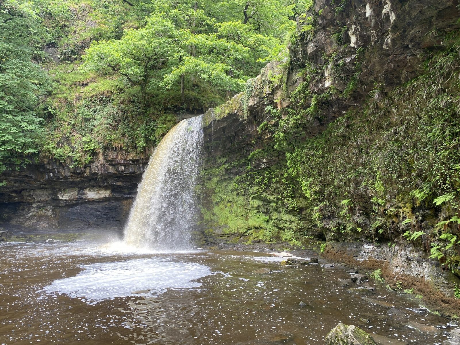
The walk starts from the car park in Pontneddfechan. Go through the gate behind the Angel Inn onto the Elidir Trail, the bed of an old horse tramway that served silica mines, and follow it up the west bank of the Nedd Fechan with the river on your right. It passes Farewell Rock, a sandstone cliff on the left, and reaches the meeting of the Nedd Fechan and the Afon Pyrddin. Do not cross the footbridge: keep left up the south bank of the Pyrddin for a few minutes to Sgwd Gwladus, where the river drops about 6 m over a ledge into a wide pool. The return is the same way.
It is 4.3 km with 52 m of ascent; allow about 1¼ hours. The grade is Easy.
The path is level at first and then uneven, with slippery rock beside the river. Do not swim, jump or wade: the water is cold, deep and fast, and there have been deaths in Waterfall Country. Until 7 October 2026 the paths beyond are closed for storm repairs: the one on the north bank of the Pyrddin and the riverside path on to Pont Melin-fach.
The village car park costs £6 a day, and roadside parking is likely to be fined. The X55 bus from Swansea and Neath runs to Pontneddfechan.
Route drawn by Global Adventurer along OpenStreetMap paths (© OpenStreetMap contributors, ODbL), with figures worked out from it. Check the forecast and the ground on the day: paths change.
Good to know
- The Elidir Trail follows the bed of a horse tramway that served silica mines
- Sgwd Gwladus, the Lady's Fall, drops about 6 m over a ledge of sandstone
- Named for Gwladus, a daughter of Brychan, the fifth-century king of Brycheiniog
- Farewell Rock, beside the path, marks the base of the South Wales coal measures
Getting there
Start: Pontneddfechan · Pay and display. 51.75589, -3.59384
Places to stay nearby
Rooms in and around Treherbert: Booking.com → Expedia →
Affiliate links: if you book, Global Adventurer earns a small commission at no cost to you.
Paths change, and the weather decides the day. The line and figures come from OpenStreetMap and our own checks; take a map, check the forecast, and turn back if it isn't right.

