Line © OpenStreetMap contributors (ODbL), checked by Global Adventurer.
The hike
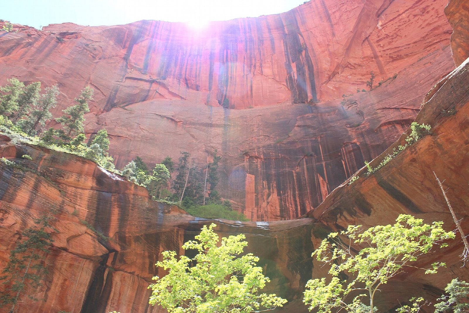
The Taylor Creek Trailhead is about two miles up Kolob Canyons Road from the visitor center at exit 40 on Interstate 15. The trail drops to the creek and follows it upstream, crossing it many times. It passes the Larson Cabin, enters a narrowing canyon between Tucupit Point and Paria Point, passes the Fife Cabin and ends at Double Arch Alcove, a great arched recess in the red cliff, streaked by seeping water. Return the same way.
It is 5 miles (8.1 km) round trip with 650 feet (198 m) of climbing; allow about 2½ hours. The grade is Easy: a steady, gentle climb, though the path is rough in places and the crossings can wet your feet in spring.
Both cabins were built by homesteaders in about 1930. There is no shuttle in Kolob Canyons: you drive in, and the park entrance fee applies. Groups are limited to 12 people and pets are not allowed. There are pit toilets at the trailhead and water at the visitor center. The road closes at times in winter, and the trail can be very icy then. Toxic cyanobacteria are present in the park's streams, so do not drink the creek water.
Route drawn by Global Adventurer along OpenStreetMap paths (© OpenStreetMap contributors, ODbL), with figures worked out from it. Check the forecast and the ground on the day: paths change.
Good to know
- In the Kolob Canyons, a quieter corner of Zion reached from I-15 exit 40
- Crosses the creek again and again, past two homesteaders' cabins from about 1930
- Ends at a vast arched alcove in the red cliff, stained by seeping water
Getting there
Start: Taylor Creek Trailhead. 37.46181, -113.19986
Places to stay nearby
Rooms in and around Zion: Booking.com → Expedia →
Affiliate links: if you book, Global Adventurer earns a small commission at no cost to you.
Paths change, and the weather decides the day. The line and figures come from OpenStreetMap and our own checks; take a map, check the forecast, and turn back if it isn't right.