Line © OpenStreetMap contributors (ODbL), checked by Global Adventurer.
The hike
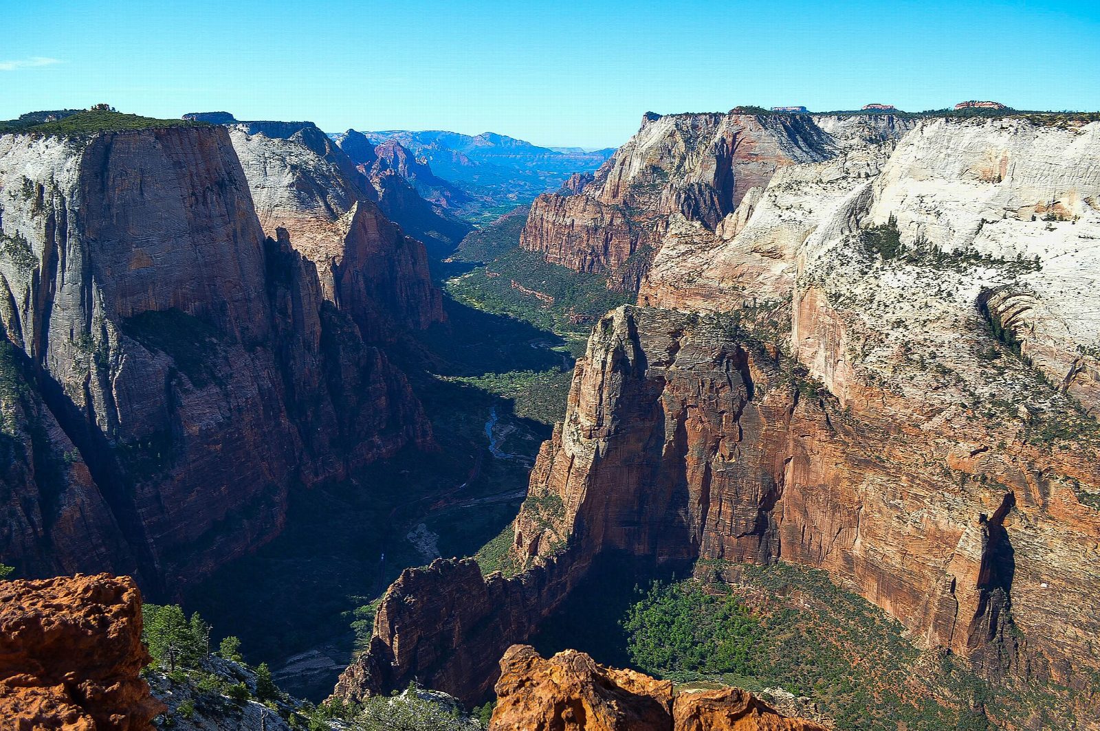
The East Mesa Trailhead is on the park's eastern boundary, reached by dirt roads through the Zion Ponderosa ranch. The East Mesa Trail runs west across a plateau of ponderosa pine, with a look into the head of Mystery Canyon after about two miles. After three miles it meets the East Rim Trail; Observation Point is 0.4 miles further, on the rim of Zion Canyon with Angels Landing below. Return the same way.
It is 7 miles (11.3 km) round trip with 700 feet (213 m) of climbing; allow about 3½ hours. The grade is Moderate: the path is broad and gentle, but it is a long walk at about 6,500 feet with no water.
This is the only way to Observation Point: the trail up from Zion Canyon has been closed by rockfall since 2019. The last roads need high clearance or four-wheel drive and can be impassable when wet. Park only in the marked spaces. East Zion Adventures runs a paid shuttle from Zion Ponderosa to within half a mile of the trailhead. There is no water at the trailhead, groups are limited to 12, and pets are not allowed.
The Zion-Mount Carmel Highway is closed to through traffic inside the park until further notice (alert of September 30, 2026), so come from the east, by US 89 and Mount Carmel Junction.
Route drawn by Global Adventurer along OpenStreetMap paths (© OpenStreetMap contributors, ODbL), with figures worked out from it. Check the forecast and the ground on the day: paths change.
Good to know
- The only way to Observation Point since rockfall closed the trail from Weeping Rock in 2019
- An easy walk along the mesa top to a point looking down on Angels Landing
- Dirt roads through Zion Ponderosa lead to the trailhead and can be impassable when wet
Summits on the way
- Observation Point 6,490 ft (1,978 m) · passed close by
Getting there
Start: East Mesa Trailhead · Free parking. 37.29659, -112.90007
Places to stay nearby
Rooms in and around Zion: Booking.com → Expedia →
Affiliate links: if you book, Global Adventurer earns a small commission at no cost to you.
Paths change, and the weather decides the day. The line and figures come from OpenStreetMap and our own checks; take a map, check the forecast, and turn back if it isn't right.
