Line © OpenStreetMap contributors (ODbL), checked by Global Adventurer.
The hike
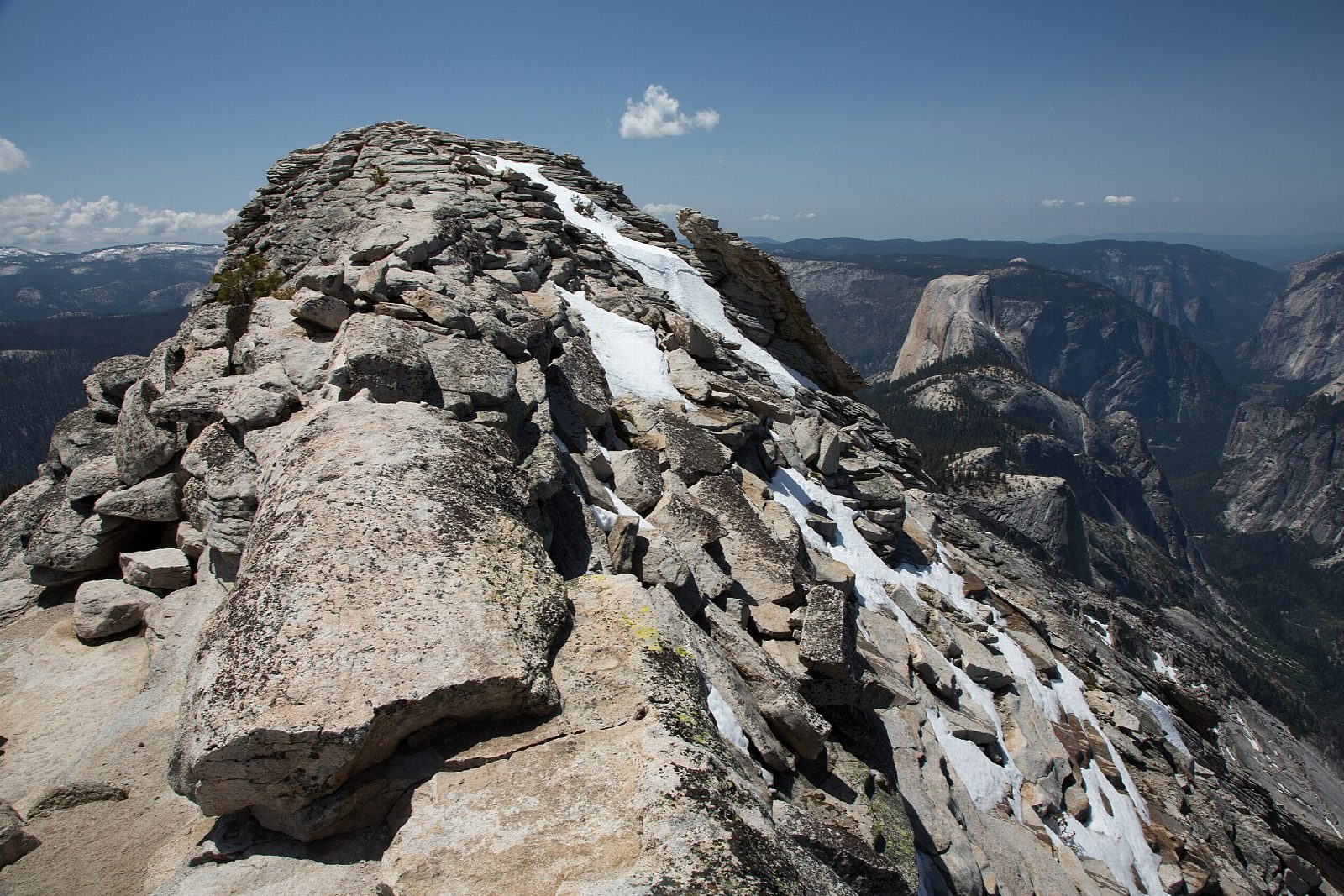
The walk starts at the Sunrise Lakes Trailhead, at the west end of Tenaya Lake on Tioga Road. The trail crosses the lake's outlet, which can be deep in early summer, then climbs about 1,000 feet in a mile of switchbacks. At the top, keep right where the Sunrise Lakes trail leaves. The trail drops into a forested basin, keeps right again at a second junction, and climbs to a narrow spine of granite that leads to the top of Clouds Rest, at 9,926 feet. Return the same way.
It is 12.2 miles (19.7 km) round trip with 2,310 feet (703 m) of climbing; allow about 7 hours. The grade is Hard: a long day, with a steep climb early and an exposed ridge to finish.
The summit ridge has long drops on both sides. The park says to stay off it in a thunderstorm or when the rock is wet; storms build most often on summer afternoons, so start early. The walk tops out near 10,000 feet: if a headache, nausea or tiredness does not ease, turn back. Treat any water you take from streams.
No permit is needed for a day hike. The trailhead lot is small. Tioga Road closes with the first big snow, usually in November, and reopens in late May or June. No overnight parking is allowed along it from October 15.
Route drawn by Global Adventurer along OpenStreetMap paths (© OpenStreetMap contributors, ODbL), with figures worked out from it. Check the forecast and the ground on the day: paths change.
Good to know
- Higher than Half Dome and looking down on it, with no permit lottery to enter
- The last stretch is a narrow granite spine with big drops on both sides
- Summer storms build most afternoons: be off the summit ridge early
Summits on the way
- Clouds Rest 9,934 ft (3,028 m)
Getting there
Start: Sunrise Lakes Trailhead. 37.82564, -119.47055
Places to stay nearby
Rooms in and around Yosemite: Booking.com → Expedia →
Affiliate links: if you book, Global Adventurer earns a small commission at no cost to you.
Paths change, and the weather decides the day. The line and figures come from OpenStreetMap and our own checks; take a map, check the forecast, and turn back if it isn't right.


