Line © OpenStreetMap contributors (ODbL), checked by Global Adventurer.
The walk
The walk starts from the car park at the National Trust for Scotland countryside centre at Morvich, near the head of Loch Duich in Kintail. It follows the road on, crosses the bridge at Innichro and takes a path beside the Abhainn Chonaig, crossing the river by a footbridge to a forest track. Beyond the plantation an old stalkers' path climbs the valley to the Bealach na Sròine, the pass below the steep north end of A' Ghlas-bheinn. The path undulates across the high ground, then descends towards the gorge of the Falls of Glomach. The return is the same way.
It is 18.3 km with 763 m of ascent; allow about 6½ hours. The grade is Hard: a long hill walk on a good path over a high pass.
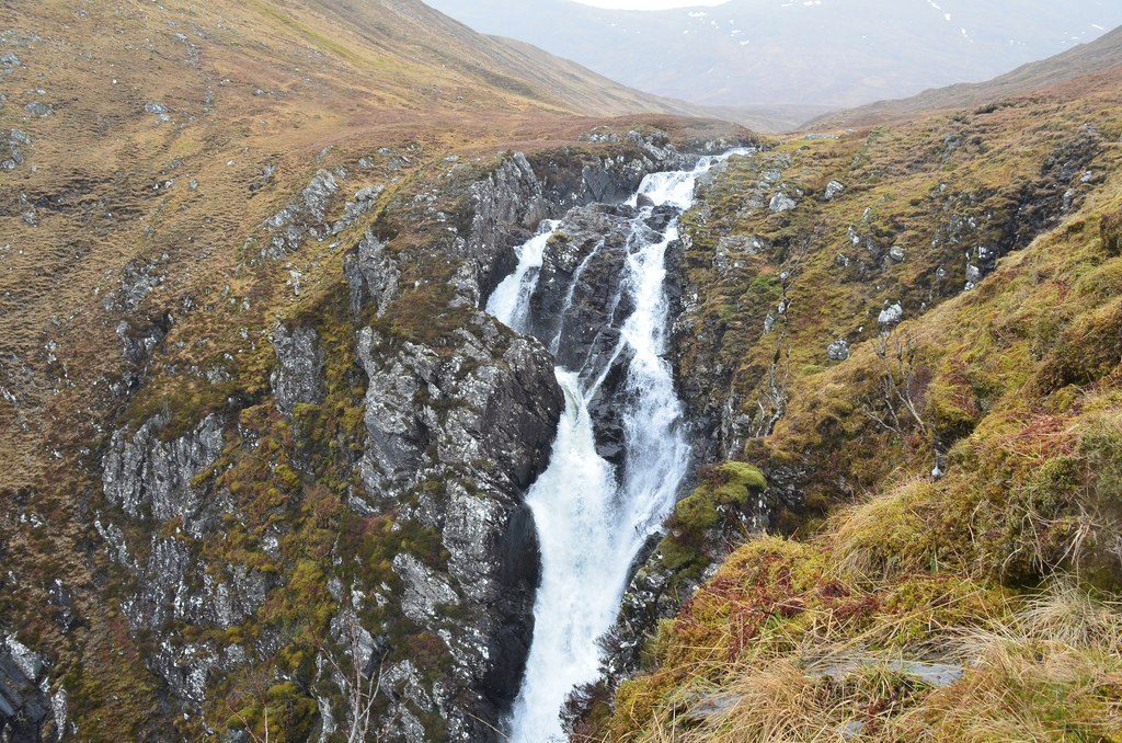
The walk crosses remote country, so it needs hillwalking skills, a map and good clothing. Only the top of the falls can be seen from the path; a rough path leads carefully down to a rocky balcony with a view of their whole height, where the Allt a' Ghlomaich drops in two great leaps. The ground beyond is dangerous and exposed.
The car park charges. There is no station nearby; Kyle of Lochalsh is the closest.
Route drawn by Global Adventurer along OpenStreetMap paths (© OpenStreetMap contributors, ODbL), with figures worked out from it. Check the forecast and the ground on the day: paths change.
Good to know
- The Allt a' Ghlomaich drops in two great leaps into a deep gorge
- The path at the falls is steep and exposed
Getting there
Start: Morvich car park · Pay and display. 57.23467, -5.38093
Places to stay nearby
Rooms in and around Stromeferry: Booking.com → Expedia →
Affiliate links: if you book, Global Adventurer earns a small commission at no cost to you.
Paths change, and the weather decides the day. The line and figures come from OpenStreetMap and our own checks; take a map, check the forecast, and turn back if it isn't right.
