Line © OpenStreetMap contributors (ODbL), checked by Global Adventurer.
The walk
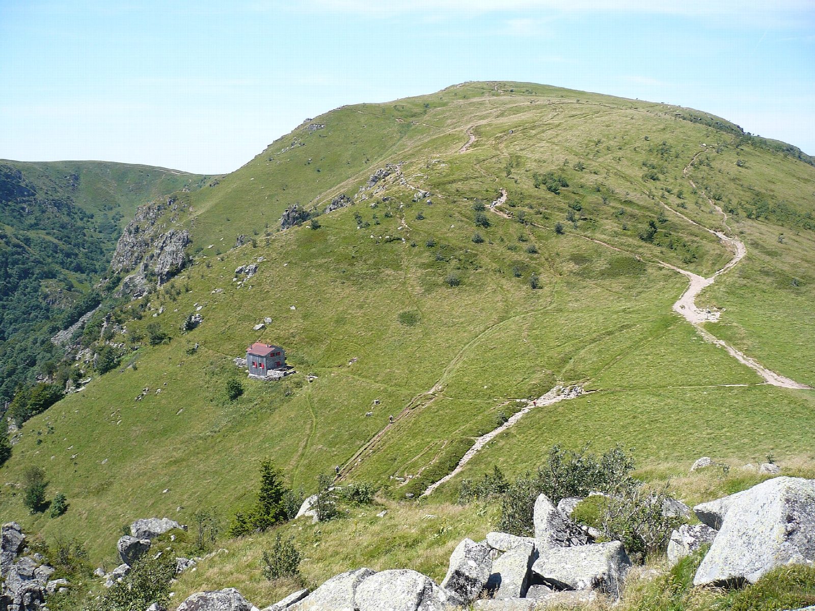
From the car park at the Col de la Schlucht, take the path south up onto the main ridge of the Vosges. It climbs gently over open high pasture, the hautes chaumes, with the cliffs and corries of the Alsace side falling away to the east and the forests of Lorraine to the west, and reaches the summit of the Hohneck, at about 1,363 m, one of the highest points of the Vosges. On a clear day the view reaches the Black Forest and, far beyond, the Alps. Return the same way.
It is 7.1 km there and back with 251 m of ascent; allow about 2½ hours. The grade is Easy: broad ridge paths with a gentle climb.
The ridge is open and exposed: wind, fog and cold come quickly, and snow covers it in winter. Keep to the paths, as the corries on the east side shelter chamois and protected plants, and stay back from the edge of the cliffs.
The car park is at the Col de la Schlucht on the road between Gérardmer and Munster.
Route drawn by Global Adventurer along OpenStreetMap paths (© OpenStreetMap contributors, ODbL), with figures worked out from it. Check the forecast and the ground on the day: paths change.
Good to know
- The Hohneck, 1,363 m, is one of the highest summits of the Vosges, with views over Alsace and the Lorraine side
- The path follows the main ridge south from the Col de la Schlucht over open high pasture
Summits on the way
- Hohneck 1,363 m
Getting there
Start: Col de la Schlucht car park. 48.06464, 7.02236
Places to stay nearby
Rooms in and around Muhlbach-sur-Munster: Booking.com → Expedia →
Affiliate links: if you book, Global Adventurer earns a small commission at no cost to you.
Paths change, and the weather decides the day. The line and figures come from OpenStreetMap and our own checks; take a map, check the forecast, and turn back if it isn't right.
