Line © OpenStreetMap contributors (ODbL), checked by Global Adventurer.
The walk
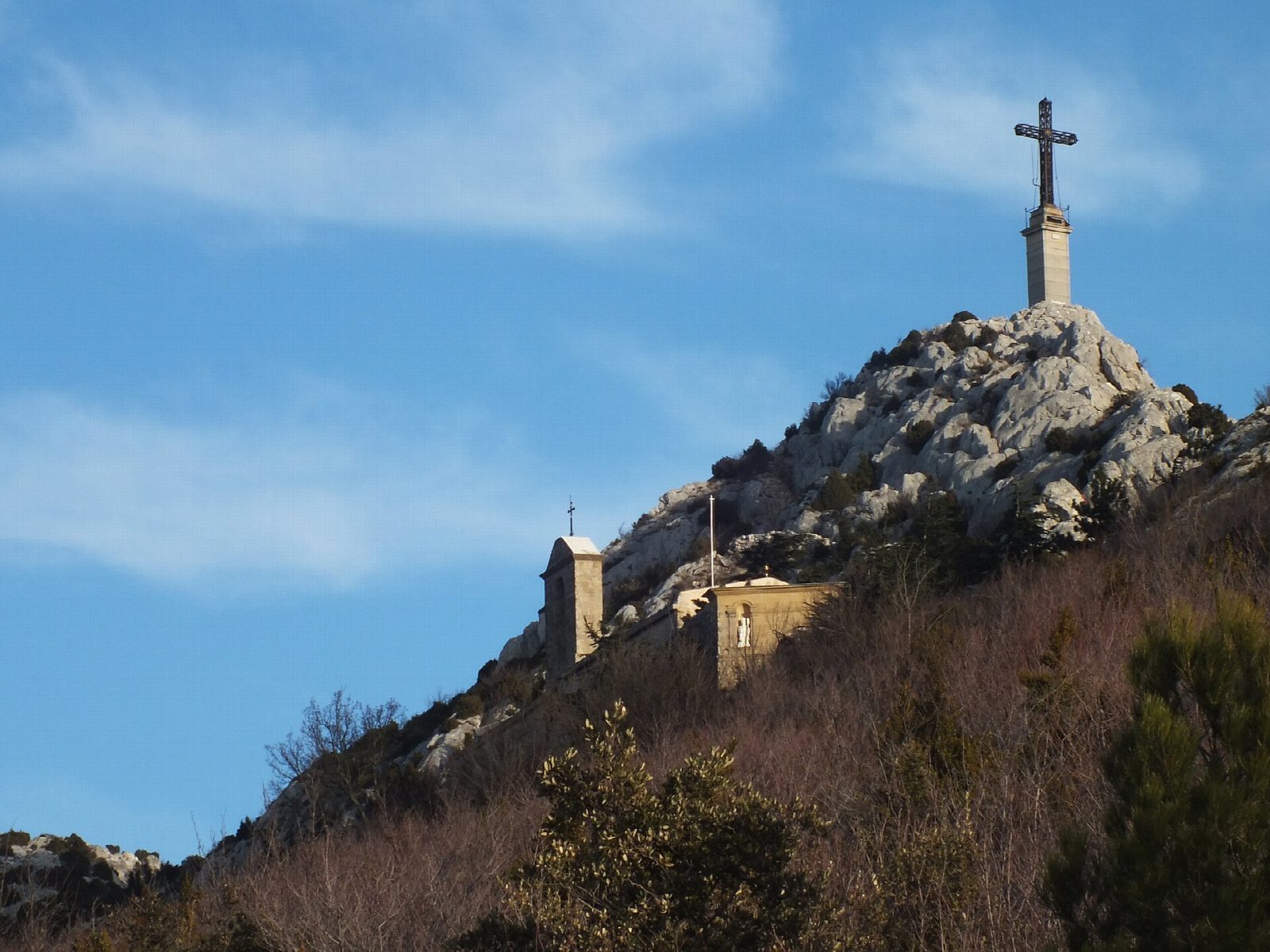
From the Parking Les Venturiers at Les Cabassols, on the road east of Vauvenargues, the Chemin des Venturiers climbs south through scrub oak and pine. It becomes a broad stony path that zigzags up the north slope of Montagne Sainte-Victoire to the Prieuré, an old priory in a saddle below the crest, and on up to the Croix de Provence, at about 946 m, a tall cross on the crest looking out over the Arc valley towards Aix-en-Provence. Return the same way.
It is 8.5 km there and back with 620 m of ascent; allow about 4½ hours. The grade is Moderate: a steady climb on a broad, stony and in places polished path.
The mountain is the one Paul Cézanne painted again and again from Aix. There is little shade, so carry plenty of water and avoid the heat of a summer afternoon. From 1 June to 30 September access to the Bouches-du-Rhône massifs is set each day by the prefecture according to the fire risk; on a red day you may not go in. The level for the next day is published between 5 and 6 pm.
The free car park is on the D10 between Vauvenargues and Puyloubier; buses from Aix stop at Les Cabassols.
Route drawn by Global Adventurer along OpenStreetMap paths (© OpenStreetMap contributors, ODbL), with figures worked out from it. Check the forecast and the ground on the day: paths change.
Good to know
- The Chemin des Venturiers climbs the north side of Montagne Sainte-Victoire to the Prieuré and the Croix de Provence at about 946 m
- The mountain is the one Paul Cézanne painted over and over from Aix-en-Provence
- From 1 June to 30 September access to the Bouches-du-Rhône massifs depends on the daily fire-risk level set by the prefecture
Summits on the way
- Croix de Provence 946 m
Getting there
Start: Parking Les Venturiers. 43.55379, 5.57928
Places to stay nearby
Rooms in and around Aix-en-Provence: Booking.com → Expedia →
Affiliate links: if you book, Global Adventurer earns a small commission at no cost to you.
Paths change, and the weather decides the day. The line and figures come from OpenStreetMap and our own checks; take a map, check the forecast, and turn back if it isn't right.