Line © OpenStreetMap contributors (ODbL), checked by Global Adventurer.
The walk
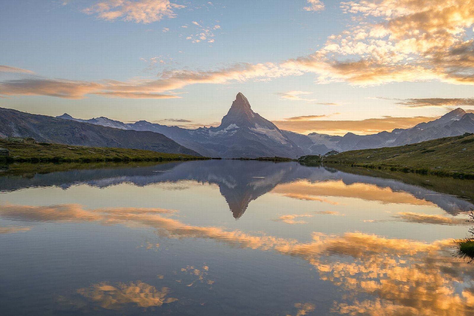
From the Blauherd gondola station, a path leads east across the slope to the Stellisee, where the Matterhorn is mirrored on a calm morning. The way then drops to the small Grindjisee among the trees and on to the Grünsee, below the moraines of the Findel glacier. A path leads west and down to the Moosjisee, a milky green reservoir in the Findelbach valley, and climbs to the Leisee, just below Sunnegga, where the walk ends.
It is 8.2 km one way with 176 m of ascent and 466 m of descent; allow about 3 hours. The grade is Easy: mountain paths and tracks, mostly downhill, with a few short climbs.
Switzerland Tourism describes it as a summer and early autumn walk. The lakes lie between about 2,100 and 2,600 m, so snow can cover the path early and late in the year. Swimming is allowed in the Grünsee and the Leisee. There are mountain restaurants near the Stellisee, at Findeln and by the Grünsee.
Zermatt is car-free; drivers park at Täsch and take the shuttle train. From Zermatt the underground funicular climbs to Sunnegga and a gondola continues to Blauherd. From Sunnegga the funicular takes you back down.
Route drawn by Global Adventurer along OpenStreetMap paths (© OpenStreetMap contributors, ODbL), with figures worked out from it. Check the forecast and the ground on the day: paths change.
Good to know
- Five lakes above Zermatt: the Stellisee, Grindjisee, Grünsee, Moosjisee and Leisee
- On a calm day the Matterhorn is reflected in three of them, most famously in the Stellisee
- Swimming is allowed in the Grünsee and the Leisee
- Up by the underground funicular from Zermatt to Sunnegga and the gondola on to Blauherd; the walk ends back at Sunnegga
Getting there
Start: Zermatt, Blauherd top station. 46.01705, 7.78527
Places to stay nearby
Rooms in and around Zermatt: Booking.com → Expedia →
Affiliate links: if you book, Global Adventurer earns a small commission at no cost to you.
Paths change, and the weather decides the day. The line and figures come from OpenStreetMap and our own checks; take a map, check the forecast, and turn back if it isn't right.