Line © OpenStreetMap contributors (ODbL), checked by Global Adventurer.
The walk
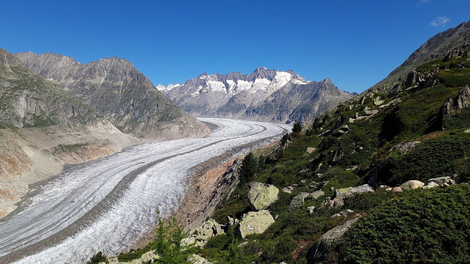
From the top of the Bettmerhorn cable car, with the Great Aletsch Glacier spread out below, the path drops north-east over stony ground to Roti Chumme. It then runs along the slope above the ice, with the Jungfrau and Mönch far up the glacier, to the Märjelen lakes and the Gletscherstube Märjela. From there a track leads into the Tälligrat tunnel, about a kilometre long and lit, and out onto the open slopes above Fiescheralp, which it follows down to the cable car station.
It is 9.3 km one way with 136 m of ascent and 584 m of descent; allow about 3 hours. The grade is Hard: mostly good paths and tracks, but the stretch below the Bettmerhorn is steep and rocky, mapped as a demanding mountain path.
Switzerland Tourism gives July to October as the season, and the route can be closed by snow or bad weather. In 2026 the Bettmerhorn cable car runs until 25 October. Further west, paths on the moving Moosfluh slope have been closed in recent years; this route avoids them. Keep off the glacier itself.
Bettmeralp and Fiescheralp are car-free: cable cars climb to them from Betten and Fiesch on the Matterhorn Gotthard railway, with parking at the valley stations.
Route drawn by Global Adventurer along OpenStreetMap paths (© OpenStreetMap contributors, ODbL), with figures worked out from it. Check the forecast and the ground on the day: paths change.
Good to know
- The Great Aletsch Glacier, the longest in the Alps, lies below the path for much of the way; it is part of the Swiss Alps Jungfrau-Aletsch World Heritage site
- From the Bettmerhorn the path drops to Roti Chumme and runs above the glacier to the Märjelen lakes and the Gletscherstube
- The way back to Fiescheralp goes through the Tälligrat tunnel, about a kilometre long and lit, first dug to carry water
- The Bettmerhorn cable car runs until 25 October 2026; paths on the moving Moosfluh slope further west have been closed in recent years
Getting there
Start: Bettmerhorn, top station of the cable car from Bettmeralp. 46.41036, 8.07714
Places to stay nearby
Rooms in and around Bettmerhorn: Booking.com → Expedia →
Affiliate links: if you book, Global Adventurer earns a small commission at no cost to you.
Paths change, and the weather decides the day. The line and figures come from OpenStreetMap and our own checks; take a map, check the forecast, and turn back if it isn't right.