Line © OpenStreetMap contributors (ODbL), checked by Global Adventurer.
The walk
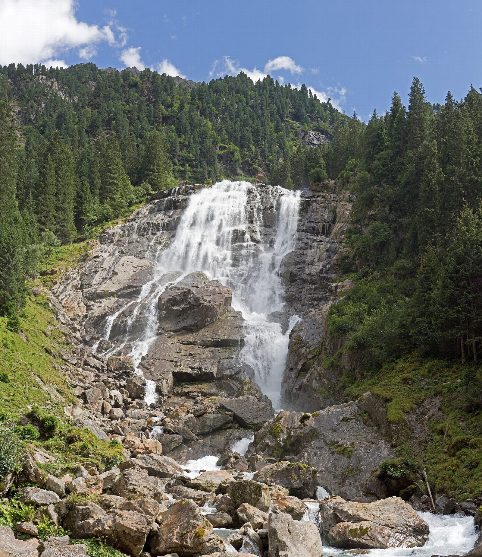
From the Raffeine car park in the upper Stubai valley, a forest path leads in a few minutes to the viewing platforms at the foot of the Grawa Waterfall, where the water spreads across a rock face about 85 m wide. Past the Grawa Alm the path climbs steeply on steps beside the falls into the hanging valley above. It levels out on the meadows of the Sulzenau Alm, with the Sulzenau Fall shooting through a cleft in the rock at the head of the valley. Return the same way.
It is 7.9 km there and back with 439 m of ascent; allow about 3½ hours. The grade is Moderate: a well-made path, steep and stepped beside the waterfall, then easier.
The falls are fullest in early summer, when the snow melts, and freeze in winter. The steps near the water are wet and slippery. The Grawa Alm and the Sulzenau Alm serve food in season; the path continues up to the Sulzenauhütte for those with more time.
Parking at Raffeine and at the Grawa Alm is free. Bus 590 from Innsbruck and Neustift stops at the Grawa Alm.
Route drawn by Global Adventurer along OpenStreetMap paths (© OpenStreetMap contributors, ODbL), with figures worked out from it. Check the forecast and the ground on the day: paths change.
Good to know
- The Grawa Waterfall, about 85 m wide, is said to be the widest in the Eastern Alps
- From the Grawa Alm the path climbs steeply on steps beside the falls to the Sulzenau Alm
- The Sulzenau Fall pours over the head of the valley above the alm
- Buses from Neustift and Innsbruck stop at the Grawa Alm
Getting there
Start: Neustift, Raffeine car park. 47.01669, 11.19412
Places to stay nearby
Rooms in and around Neustift: Booking.com → Expedia →
Affiliate links: if you book, Global Adventurer earns a small commission at no cost to you.
Paths change, and the weather decides the day. The line and figures come from OpenStreetMap and our own checks; take a map, check the forecast, and turn back if it isn't right.