Line © OpenStreetMap contributors (ODbL), checked by Global Adventurer.
The walk
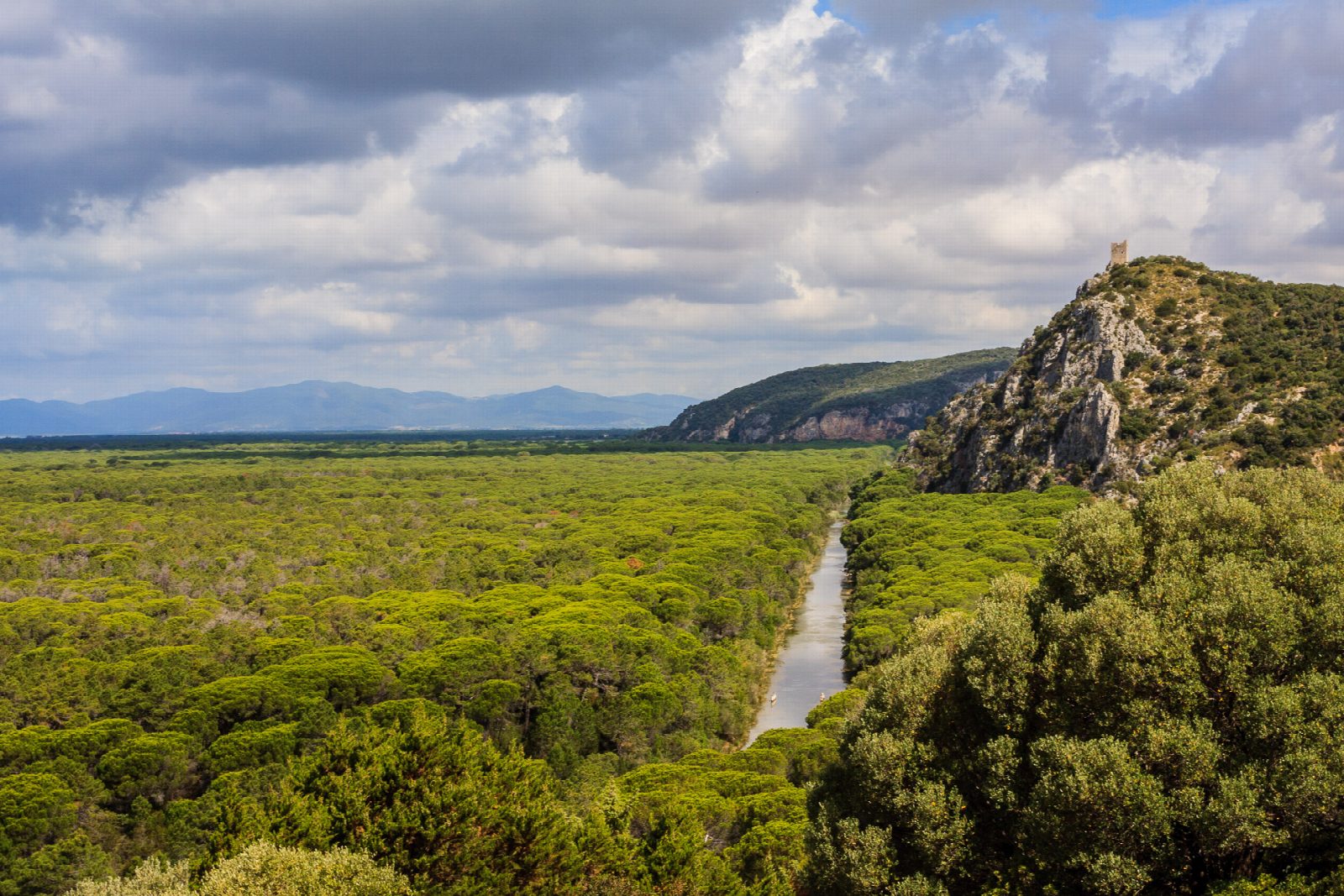
From the Casetta dei Pinottolai car park, the walk follows the grand-ducal pine wood, planted in the 1800s, and crosses the Ponte delle Tartarughe over the Scoglietto and Collelungo canal. It climbs through Mediterranean scrub to the Torre di Castel Marino, recorded since the 13th century, and goes down to the old olive grove of Collelungo and the Torre di Collelungo, above the sea and the beach of Collelungo. It returns along the canal path through the pine wood.
It is 10.3 km round with 128 m of ascent; allow about 3 hours. The grade is Easy: flat tracks through the pine wood and one short climb to Castel Marino.
A park ticket is needed: €10, reduced €5, in 2026, sold at the visitor centre in Alberese (daily 8:30 to 15:00) or online in autumn and winter. From mid-June to mid-September this walk can be done only with a guide, because of the fire risk; in October you may walk it on your own. The park opens from 8:30 to an hour before sunset. Dogs are not allowed. Fallow deer, wild boar, porcupines and pond turtles are often seen.
The bridge over the Perazzeta canal on the road to Marina di Alberese has been closed since 21 September 2026; the park has opened another way to the start of the walks from Pratini and the Pinottolai.
Route drawn by Global Adventurer along OpenStreetMap paths (© OpenStreetMap contributors, ODbL), with figures worked out from it. Check the forecast and the ground on the day: paths change.
Good to know
- Through the grand-ducal pine wood of the 1800s to two coastal watchtowers built against pirates
- Fallow deer, wild boar, porcupines and pond turtles are often seen
- The Parco della Maremma was set up in 1975; the Uccellina hills behind rise to 417 m
- A park ticket is needed and dogs are not allowed
Getting there
Start: Casetta dei Pinottolai car park. 42.66329, 11.04310
Places to stay nearby
Rooms in and around Tuscany: Booking.com → Expedia →
Affiliate links: if you book, Global Adventurer earns a small commission at no cost to you.
Paths change, and the weather decides the day. The line and figures come from OpenStreetMap and our own checks; take a map, check the forecast, and turn back if it isn't right.