Line © OpenStreetMap contributors (ODbL), checked by Global Adventurer.
The walk
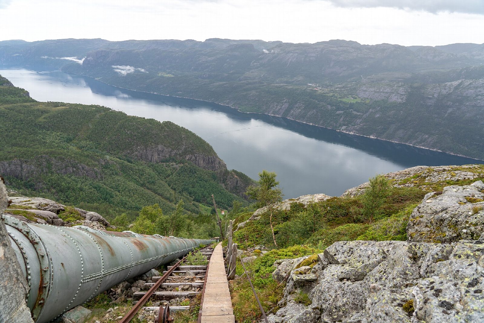
Flørli has no road: you arrive by boat at the quay below the old power station. The wooden stairs start behind the hamlet and climb beside the penstock, 1,470 m long and 740 m high, to the dam at Ternevatnet. From the top the Rallarstien (the navvies' path), made by the men who built the power station more than a hundred years ago, leads down past cairns and over a field of stones, crosses the Flørliåa on a bridge and comes back through the woods to Flørli and the quay.
It is 5.4 km round with 736 m of ascent; allow about 4½ hours. The grade is Moderate by our reckoning of time, though DNT and Fjord Norway call it demanding: the stairs never let up and the path down is steep.
Walk up the stairs, not down: Fjord Norway warns against coming down them, as they are narrow and steep and you meet people climbing. It gives the season as mid-April to the end of October; in winter there is a risk of avalanches and of slipping on the steep slopes.
Boats between Lauvvik and Lysebotn call at Flørli, and tickets should be booked in high season. There is a guest jetty for private boats.
Route drawn by Global Adventurer along OpenStreetMap paths (© OpenStreetMap contributors, ODbL), with figures worked out from it. Check the forecast and the ground on the day: paths change.
Good to know
- 4,444 wooden steps beside the old penstock, 1,470 m long, climbing 740 m from the fjord to Ternevatnet
- Down by the Rallarstien, the path the builders of the power station used more than 100 years ago
- No road: Flørli is reached by boat on the Lysefjord, so book ahead in high season
- Do not come down the stairs: they are narrow and steep
Getting there
Start: Flørli ferry quay. 59.01527, 6.43133
Places to stay nearby
Rooms in and around Stavanger and Lysefjord: Booking.com → Expedia →
Affiliate links: if you book, Global Adventurer earns a small commission at no cost to you.
Paths change, and the weather decides the day. The line and figures come from OpenStreetMap and our own checks; take a map, check the forecast, and turn back if it isn't right.