Line © OpenStreetMap contributors (ODbL), checked by Global Adventurer.
The walk
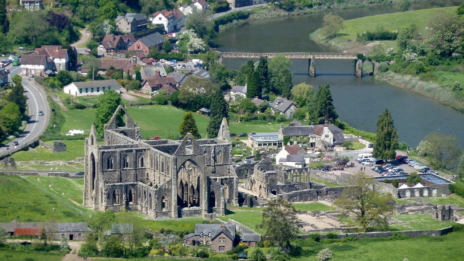
The walk starts from the car park at Tintern Abbey. Cross the Wye into England by the Wireworks Bridge, an old railway bridge. A path climbs steeply through the woods to the Offa's Dyke Path near the crest. A short way south is the Devil's Pulpit, a limestone outcrop looking straight down on the abbey. Walk north along the dyke for about 2 km and take the green lane down to Brockweir. Cross the road bridge back into Wales and follow the Wye Valley Walk south beside the river to Tintern Old Station and round the river bend to the church at Tintern Parva. The main road leads back to the abbey.
It is 8.5 km with 248 m of ascent; allow about 2¾ hours. The grade is Easy, but the climb from the river to the dyke is steep.
The woodland paths are stony and muddy after rain, with many junctions: follow the Offa's Dyke acorns on the top, and take a map. The pulpit stands above a steep drop. About a fifth of the walk is on roads, mostly the A466 through Tintern Parva and the village, where the limit is 20 mph.
The abbey car park is small and charges; the Old Station has a larger pay car park and a visitor centre, and the walk can start there instead. Buses from Chepstow stop in Tintern.
Route drawn by Global Adventurer along OpenStreetMap paths (© OpenStreetMap contributors, ODbL), with figures worked out from it. Check the forecast and the ground on the day: paths change.
Good to know
- The Devil's Pulpit is a limestone outcrop by Offa's Dyke that looks straight down on Tintern Abbey
- The Devil, the story goes, taunted the monks from it
- The pulpit stands in Gloucestershire: the Wye here is the border
- Back by Brockweir and the old Tintern station on the Wye Valley Railway
Getting there
Start: Tintern Abbey car park · Pay and display. 51.69786, -2.67736
Places to stay nearby
Rooms in and around Chepstow: Booking.com → Expedia →
Affiliate links: if you book, Global Adventurer earns a small commission at no cost to you.
Paths change, and the weather decides the day. The line and figures come from OpenStreetMap and our own checks; take a map, check the forecast, and turn back if it isn't right.