Line © OpenStreetMap contributors (ODbL), checked by Global Adventurer.
The walk
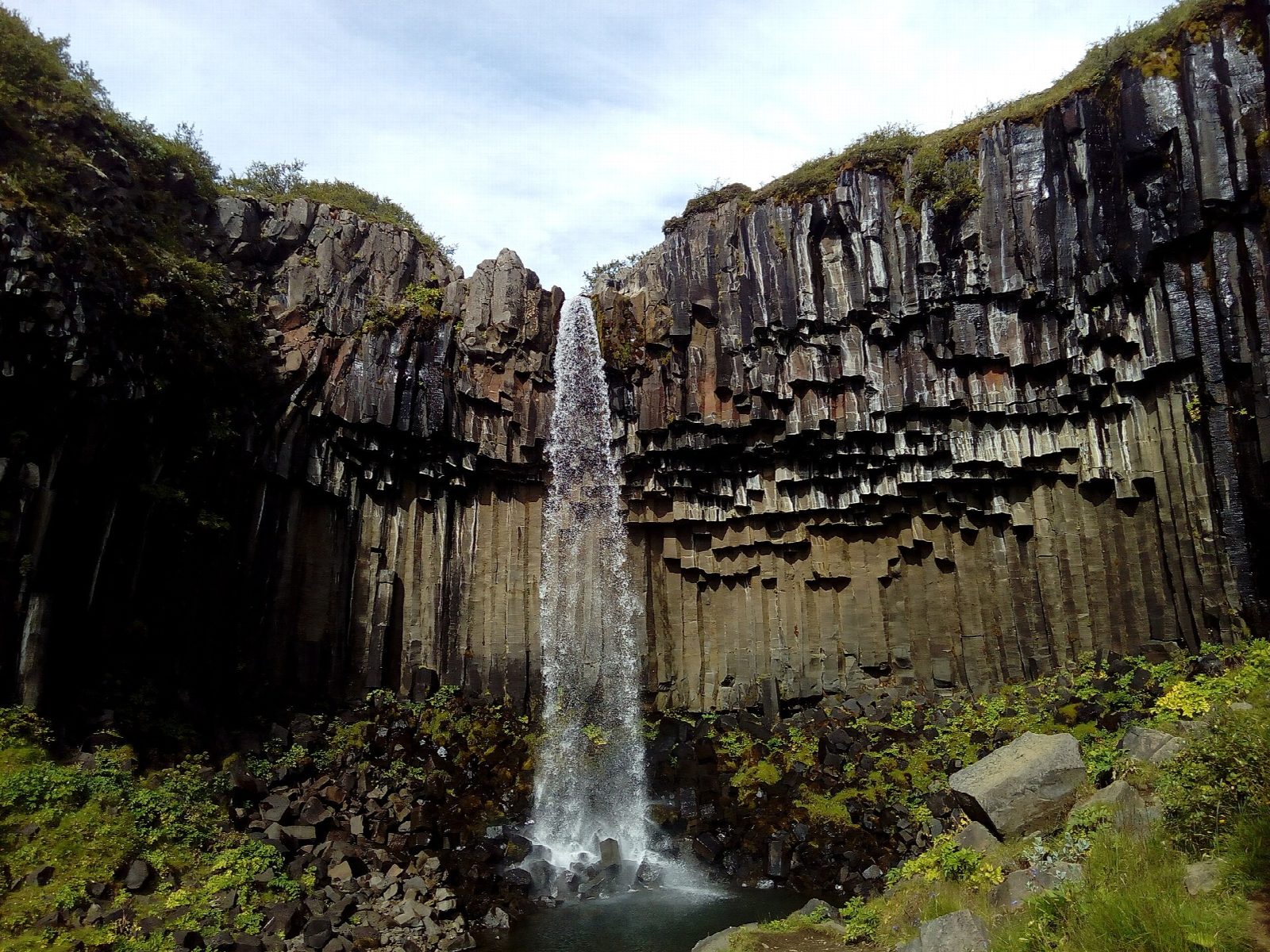
From the car park by Skaftafellsstofa, the visitor centre, walk through the campsite and turn uphill on the Svartifoss path, keeping on past the first sign for Sjónarnípa. Climb past Hundafoss and Magnúsarfoss to the viewpoint below Svartifoss, where the water falls over dark basalt columns. Come back a few metres and take the marked path east, over a boardwalk and a footbridge, then across the moor of Austastaheiði to Sjónarnípa. It looks down on the glacier Skaftafellsjökull, with Öræfajökull behind. Return south-west down Austurbrekkur, along the edge above the glacier, to the campsite. The loop goes clockwise.
It is 8.1 km round with 276 m of ascent; allow about 2½ hours. The grade is Moderate: marked paths and a steady climb, steep and sometimes loose near Svartifoss.
The national park rates the loop challenging, and the descent down Austurbrekkur runs close to a drop above the glacier. In spring and early summer birds nest along the way: keep to the path and keep dogs on a lead. The paths ice over in winter, so carry microspikes from late autumn.
Vatnajökull National Park charges a daily parking fee at Skaftafell, 1,110 ISK for a car in 2026; cameras read number plates, and you pay online or at the machines. Strætó route 52, between Reykjavík and Höfn, stops beside the visitor centre, on fewer days in winter.
Route drawn by Global Adventurer along OpenStreetMap paths (© OpenStreetMap contributors, ODbL), with figures worked out from it. Check the forecast and the ground on the day: paths change.
Good to know
- Svartifoss falls over a ledge of dark basalt columns, formed where a thick lava flow cooled slowly
- Sjónarnípa looks down on Skaftafellsjökull, an outlet glacier of Vatnajökull, with Öræfajökull behind
- Hundafoss and Magnúsarfoss are passed on the climb to Svartifoss
- Skaftafell became part of Vatnajökull National Park in 2008
Getting there
Start: Skaftafell visitor centre car park. 64.01453, -16.96850
Places to stay nearby
Rooms in and around South Iceland: Booking.com → Expedia →
Affiliate links: if you book, Global Adventurer earns a small commission at no cost to you.
Paths change, and the weather decides the day. The line and figures come from OpenStreetMap and our own checks; take a map, check the forecast, and turn back if it isn't right.