Line © OpenStreetMap contributors (ODbL), checked by Global Adventurer.
The walk
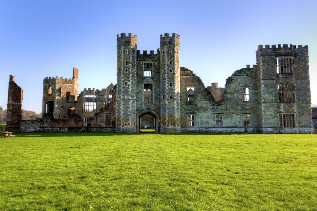
From North Street car park the walk goes along the causeway to the Cowdray ruins, the shell of a great Tudor house burnt out in 1793, and back. It then goes up North Street to the bridge over the River Rother, where the Rother Walk leaves the road. The path follows the river upstream, past the weir and over a boardwalk through wet woodland, then along field edges to Woolbeding Parkland, National Trust land grazed by cattle. It turns south through the parkland to the A272 by the Half Moon, and June Lane leads back down to North Street and the car park.
It is 5.7 km with 49 m of ascent; allow about 1½ hours. The grade is Easy: nearly level, on riverside paths, parkland and a lane.
The riverside path is muddy, most of all in winter, and there is one stile. Keep dogs under close control among the cattle. June Lane has no pavement for about a kilometre, and the A272 must be crossed by the Half Moon: take care at both.
North Street car park charges, with the first hour free: 90p for two hours and £1.40 for four on the latest tariff seen. There is no station in Midhurst. The South Downs Centre, in Capron House beside the car park, has maps and local information.
Route drawn by Global Adventurer along OpenStreetMap paths (© OpenStreetMap contributors, ODbL), with figures worked out from it. Check the forecast and the ground on the day: paths change.
Good to know
- Along the causeway to the Cowdray ruins, a great Tudor house burnt out in 1793
- Then up the River Rother on the Rother Walk to Woolbeding Parkland and back by June Lane
- Henry VIII and Elizabeth I both stayed at Cowdray
- The South Downs Centre is in Capron House by the car park
Getting there
Start: North Street car park, Midhurst · Pay and display. 50.98861, -0.73733
Places to stay nearby
Rooms in and around North Street car park: Booking.com → Expedia →
Affiliate links: if you book, Global Adventurer earns a small commission at no cost to you.
Paths change, and the weather decides the day. The line and figures come from OpenStreetMap and our own checks; take a map, check the forecast, and turn back if it isn't right.
