Line © OpenStreetMap contributors (ODbL), checked by Global Adventurer.
The walk
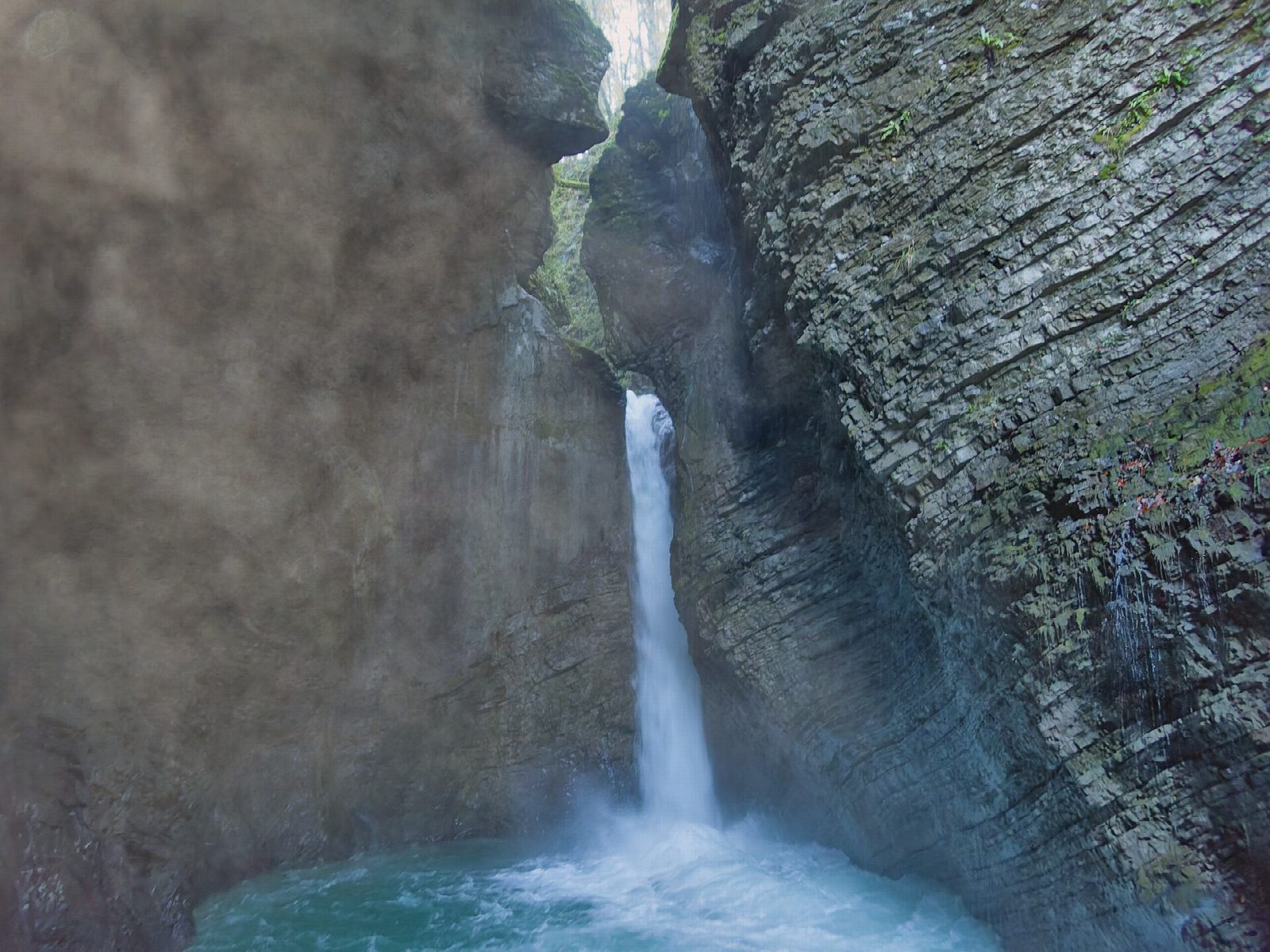
From the centre of Kobarid, climb the lane to the Italian Charnel House on the hill of St Anthony, then follow the path north through woods to Tonovcov grad, an old hilltop settlement above the Soča. The way drops to the river, crosses it and follows the Kozjak stream up a made path with small wooden footbridges to a terrace facing the waterfall, which falls 15 m into a dark rock bowl with a green pool at its foot. Return down the stream and along the Soča to Napoleon Bridge and back into Kobarid.
It is 7.4 km round with 220 m of ascent; allow about 2½ hours. The grade is Easy: forest paths and lanes, steep in places, with steps near the falls.
The last stretch to the falls has a ticket point, €5 for adults in 2026, staffed from 2 April to 31 October. The pool below the falls is part of a protected natural monument and is not for bathing. Paths by the river are slippery after rain.
Park in the pay car parks in the centre of Kobarid, which is on the bus routes along the Soča valley.
Route drawn by Global Adventurer along OpenStreetMap paths (© OpenStreetMap contributors, ODbL), with figures worked out from it. Check the forecast and the ground on the day: paths change.
Good to know
- The Kozjak stream drops 15 m into a dark rock amphitheatre with a green pool at its foot
- The pool is part of a protected natural monument and is not for bathing
- The round follows Kobarid's historical trail past First World War sites above the Soča
- Napoleon Bridge crosses the Soča in a narrow gorge just outside the town
Summits on the way
- Stari grad 412 m · passed close by
Getting there
Start: Kobarid, town centre car park · Pay and display. 46.24694, 13.57978
Places to stay nearby
Rooms in and around Kobarid: Booking.com → Expedia →
Affiliate links: if you book, Global Adventurer earns a small commission at no cost to you.
Paths change, and the weather decides the day. The line and figures come from OpenStreetMap and our own checks; take a map, check the forecast, and turn back if it isn't right.