Line © OpenStreetMap contributors (ODbL), checked by Global Adventurer.
The walk
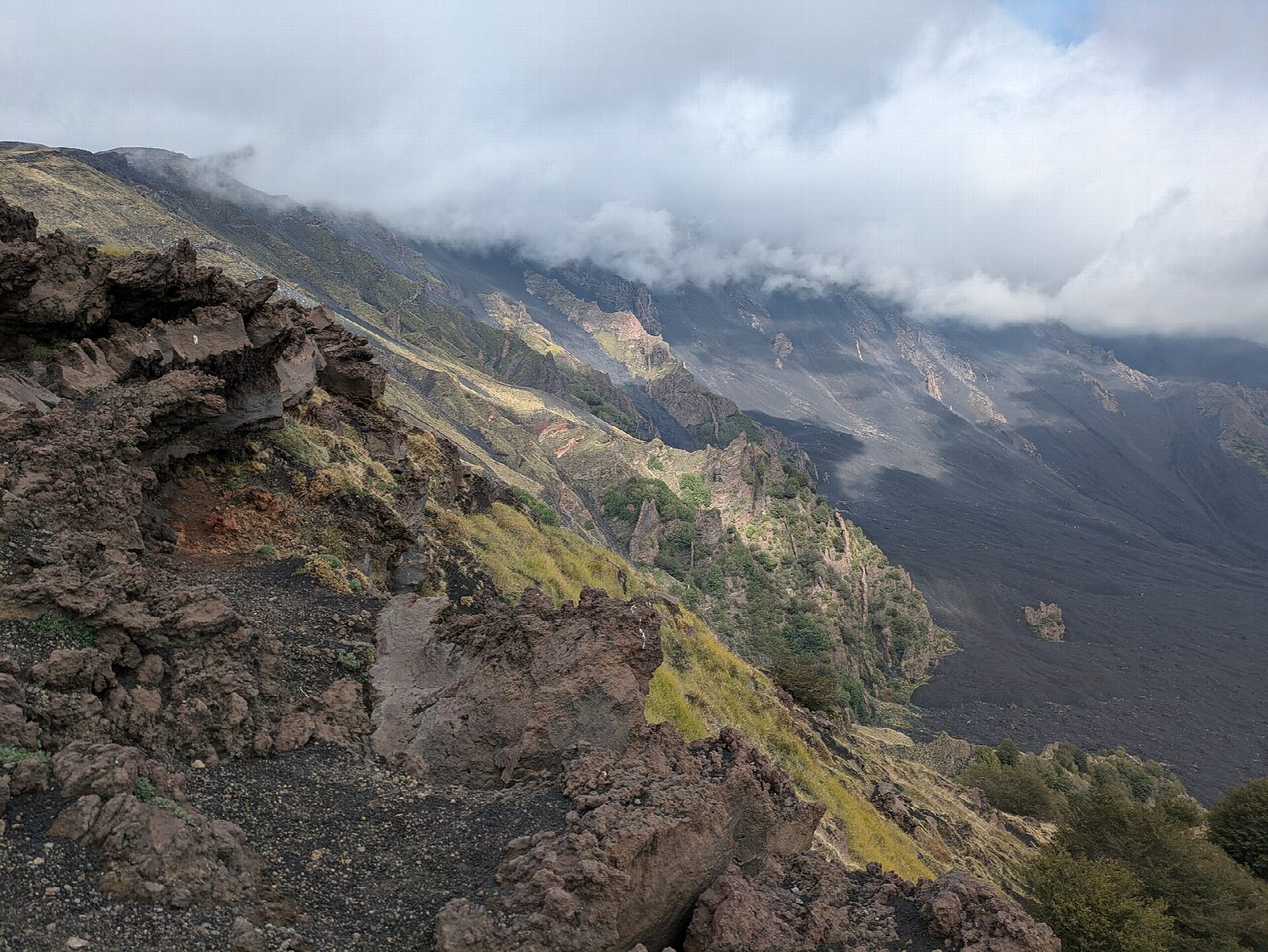
From the car park at the junction of the road from Zafferana to Rifugio Sapienza (SP92) and the road from Pedara, at about 1,850 m, a forest track climbs steeply through planted pine and Etna broom. Higher up it crosses a plateau of spiny cushion plants to the Schiena dell'Asino, the rim above the Valle del Bove, a vast volcano-tectonic hollow on the east side of Etna. Return the same way.
It is 4.8 km there and back with 266 m of ascent; allow about 2 hours. The grade is Easy: a broad track on volcanic sand and cinder, steep at first.
From the rim you see cones and lava flows of the eruption of 1792. A short detour leads to the Grotta Pitagora, a cave that holds ice in winter. Saponaria sicula, the park's symbol plant, grows on the plateau. Access near the summit of Etna depends on the civil protection's alert phase: in August 2026 the zone round the active craters was closed to all walkers, and under the highest phase the whole summit zone, which includes the upper Valle del Bove, is closed. This path stays well below the craters, but check the current notice before you go.
The car park at the start is free. Rifugio Sapienza, with paid car parks and the Etna cable car, is a short way up the road.
Route drawn by Global Adventurer along OpenStreetMap paths (© OpenStreetMap contributors, ODbL), with figures worked out from it. Check the forecast and the ground on the day: paths change.
Good to know
- Up through planted pine and Etna broom to the edge of the Valle del Bove, a vast volcano-tectonic hollow on Etna's east side
- Cones and lava flows of the 1792 eruption are seen from the rim
- A short detour leads to the Grotta Pitagora, a cave that holds ice in winter
- Saponaria sicula, the Etna park's symbol plant, grows on the plateau
Summits on the way
- Monte Lupo · passed close by
Getting there
Start: Schiena dell'Asino car park · Free parking. 37.70130, 15.01507
Places to stay nearby
Rooms in and around Sicily: Booking.com → Expedia →
Affiliate links: if you book, Global Adventurer earns a small commission at no cost to you.
Paths change, and the weather decides the day. The line and figures come from OpenStreetMap and our own checks; take a map, check the forecast, and turn back if it isn't right.
