Line © OpenStreetMap contributors (ODbL), checked by Global Adventurer.
The walk
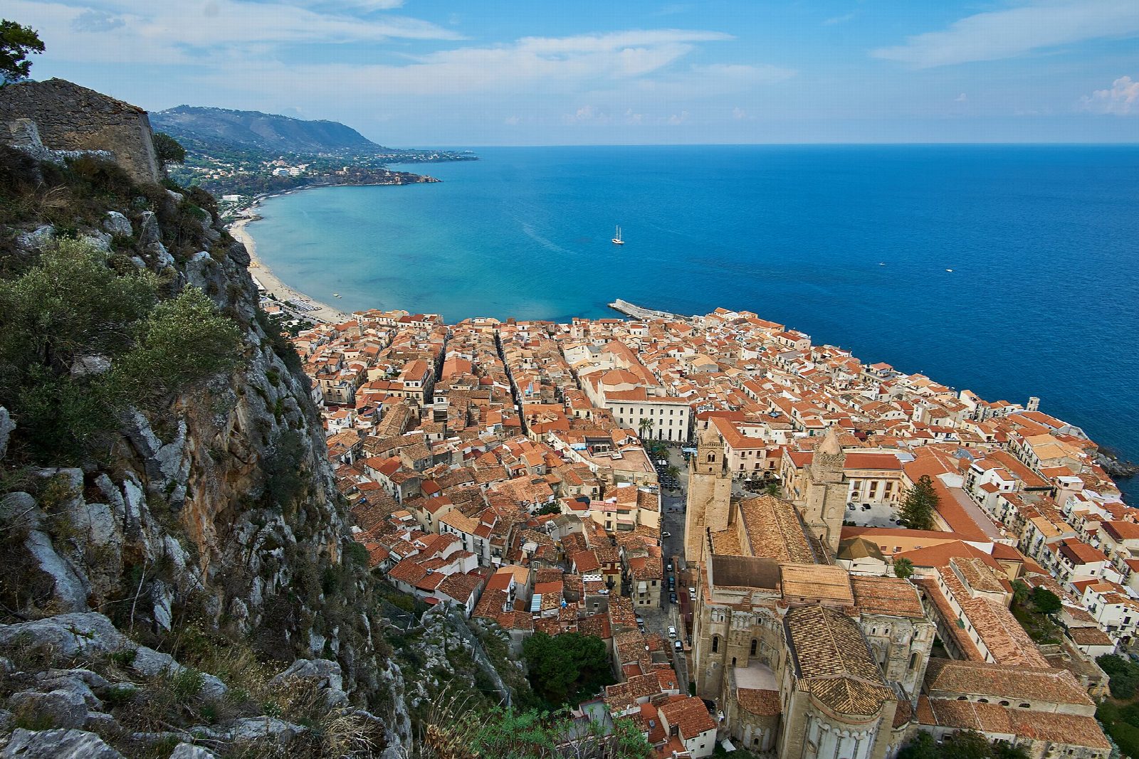
From the car park at the edge of the old town, walk through the streets to Corso Ruggero and the start of the Salita Saraceni. The stepped path climbs the west side of La Rocca, the limestone headland that rises 268 m above the town, beside medieval walls with battlements, to the Tempio di Diana halfway up, and on to the ruins of the castle at the top. Return the same way.
It is 3.2 km there and back with 221 m of ascent; allow about 1½ hours. The grade is Easy: steps and a stony path, steep in places and exposed to the sun.
The path is ticketed: €5, reduced €2.50 for ages 6 to 14, over-65s and teachers. In winter (standard time) it is open from 8:00 to 17:00, with last entry at 15:00; from mid-September to the end of summer time, from 8:00 to 19:00, with last entry at 17:00. The megalithic Tempio di Diana is dated to the 9th century BC and the castle to about the 13th century. From the top the view runs along the coast from Palermo to Capo d'Orlando.
The car park is paid, and Cefalù station is a short walk from the old town.
Route drawn by Global Adventurer along OpenStreetMap paths (© OpenStreetMap contributors, ODbL), with figures worked out from it. Check the forecast and the ground on the day: paths change.
Good to know
- The limestone headland of La Rocca rises 268 m straight above the old town and the cathedral
- The megalithic Tempio di Diana is dated to the 9th century BC
- Medieval walls climb the west side to the ruins of a castle at the top
- The view runs along the coast from Palermo to Capo d'Orlando
Summits on the way
- Rocca di Cefalù 268 m · passed close by
Getting there
Start: Cefalù car park · Pay and display. 38.03439, 14.02181
By train: Cefalù station is 0.3 km from the start.
Places to stay nearby
Rooms in and around Cefalù: Booking.com → Expedia →
Affiliate links: if you book, Global Adventurer earns a small commission at no cost to you.
Paths change, and the weather decides the day. The line and figures come from OpenStreetMap and our own checks; take a map, check the forecast, and turn back if it isn't right.
