Line © OpenStreetMap contributors (ODbL), checked by Global Adventurer.
The walk
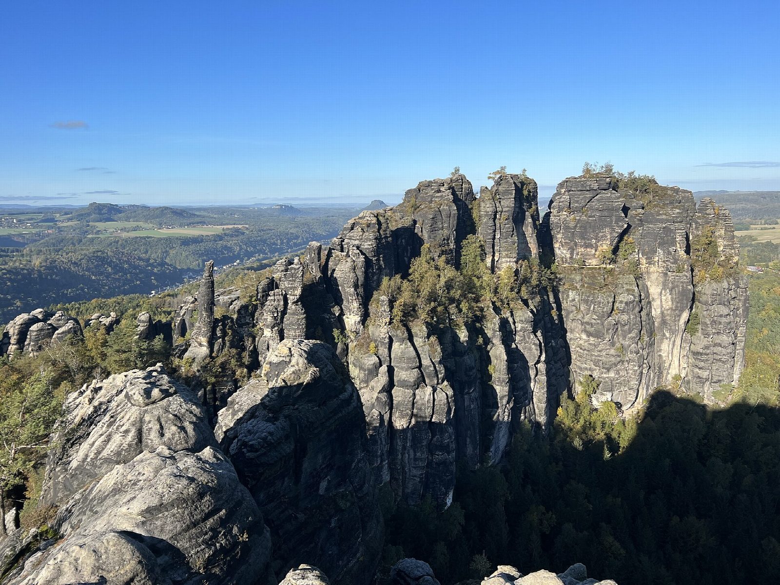
The walk starts from the pay car park at Ostrau, above Bad Schandau. It goes out to the Emmabank viewpoint over the Elbe, down the Klüftel and up the wooded Lattengrund to the Schrammtor, a gap between sandstone towers. From there the Wildschützensteig climbs to the ridge on metal stairs, ladders and planks, and a short path leads to the Schrammsteinaussicht, a railed ledge at about 417 m with a view over the whole rock chain and the Elbe valley. The way down is by the Mittelwinkel, then back under the rocks and through the Schießgrund to Ostrau.
It is 8.2 km with 262 m of ascent; allow about 3 hours. The grade is Moderate.
The Wildschützensteig is one-way, uphill only, and with the ridge it needs sure feet and a head for heights; it is no place for dogs, and dangerous in ice. It is a marked walkers' path, not a via ferrata, and needs no equipment.
This is the national park's core: keep to marked paths, light no fire, fly no drone and keep dogs on a lead. No closures were listed for the Schrammsteine at the start of October 2026, but paths here have been closed after fires and rockfalls, so check the park's path notices. Bus 252 runs from Bad Schandau to Ostrau.
Route drawn by Global Adventurer along OpenStreetMap paths (© OpenStreetMap contributors, ODbL), with figures worked out from it. Check the forecast and the ground on the day: paths change.
Good to know
- The Schrammsteine are a long wall of sandstone towers above the Elbe near Bad Schandau
- The Wildschützensteig climbs to the ridge on iron stairs and ladders; it is one-way, uphill only
- The viewpoint is on a fenced rock ledge at the end of the ridge
- In Saxon Switzerland National Park: keep to the marked paths; no fires, no drones, dogs on a lead
Summits on the way
- Hüttenwart · passed close by
- Bierdeckel · passed close by
- Viererturm · passed close by
- Unbenannte Spitze 345 m · passed close by
- Spitzer Turm 343 m · passed close by
- Gottfried-Bauch-Spitze · passed close by
- Schrammtorfreund · passed close by
- Schrammtorwächter 358 m · passed close by
- Max und Moritz · passed close by
- Nördlicher Osterturm 371 m · passed close by
- Südlicher Osterturm 366 m · passed close by
- Ostervorturm · passed close by
- Zackenkrone · passed close by
- Fotografenspitze · passed close by
- Südlicher Schrammturm · passed close by
- Westlicher Schrammturm · passed close by
- Östlicher Schrammturm · passed close by
- Nördlicher Schrammturm · passed close by
- Dreifingerturm 374 m · passed close by
- Schrammsteinkegel · passed close by
- Schrammsteinnadel · passed close by
- Golem · passed close by
- Schrammsteinscheibe · passed close by
- Wetterhaube · passed close by
- Mädel · passed close by
- Jungfer · passed close by
- Eunuch · passed close by
- Wildschützenkopf · passed close by
- Wildschützennadel · passed close by
- Schrammsteinwächter · passed close by
- Mittelturm · passed close by
- Sonnenwendkegel · passed close by
- Neffe · passed close by
- Nichte · passed close by
- Onkel · passed close by
- Schrammsteine · passed close by
- Schwager · passed close by
- Baustein · passed close by
- Hirschzahn · passed close by
- Rübezahlkeule · passed close by
- Rübezahl · passed close by
- Schießgrundscheibe · passed close by
- Zahnsgrundwächter · passed close by
- Zahnsgrundturm · passed close by
- Götze · passed close by
Getting there
Start: Ostrau car park · Pay and display. 50.91967, 14.18002
Places to stay nearby
Rooms in and around Saxon Switzerland: Booking.com → Expedia →
Affiliate links: if you book, Global Adventurer earns a small commission at no cost to you.
Paths change, and the weather decides the day. The line and figures come from OpenStreetMap and our own checks; take a map, check the forecast, and turn back if it isn't right.