Line © OpenStreetMap contributors (ODbL), checked by Global Adventurer.
The walk
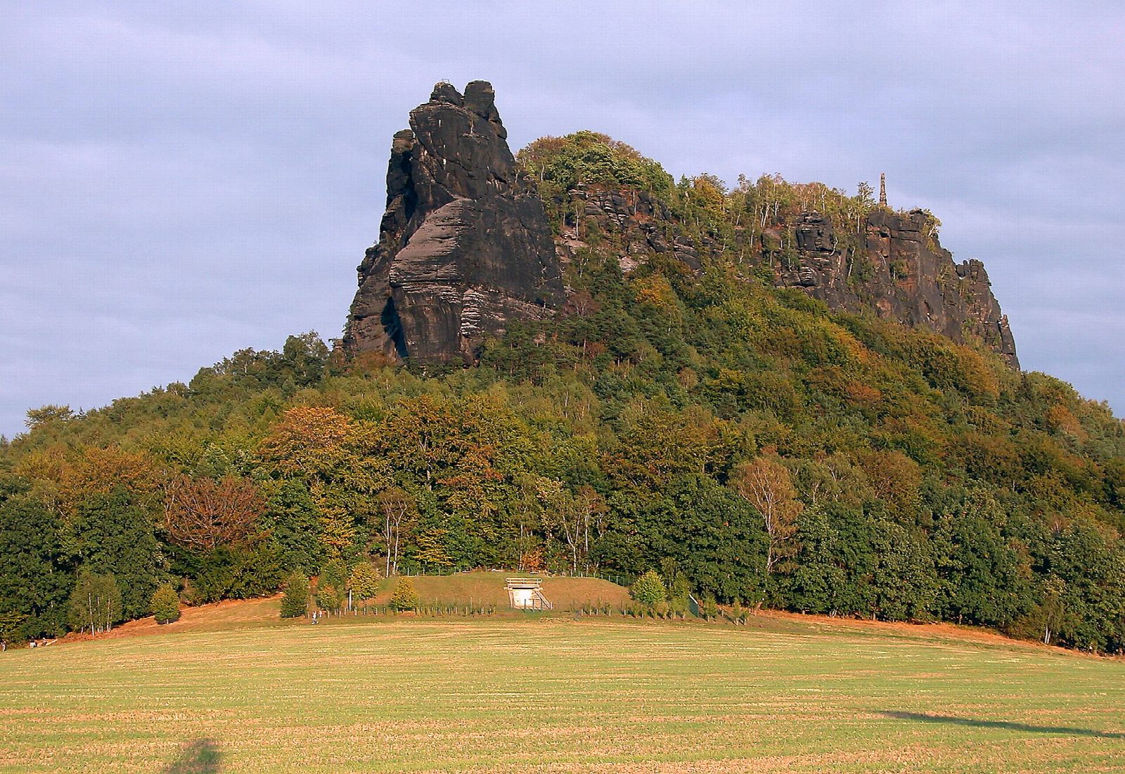
The walk starts at the S-Bahn halt in Königstein and crosses the Elbe by the passenger ferry to Halbestadt. A lane and field path climb to the foot of the Lilienstein, and the south ascent, first cut in 1708 for Augustus the Strong, goes up by steep steps to the plateau at 415 m. Paths lead round the top to viewpoints on every side, the obelisk put up in 1889 for the House of Wettin, and the inn. The way down is the north descent, on steel ladders and gratings, then round the east side of the hill and back to the ferry.
It is 5 km with 288 m of ascent; allow about 2¼ hours. The grade is Easy by time, but it is a stiff little climb.
The Lilienstein is the only table mountain on the right bank of the Elbe and the emblem of the national park. It stands alone in a bend of the river, facing Königstein Fortress, with the whole of Saxon Switzerland laid out around it.
The ladders on the north side are no good for dogs, and both stairs are dangerous in snow and ice. The ferry charges a small fare and takes local transport tickets. In the national park keep to marked paths; no fires, no drones, dogs on a lead.
Route drawn by Global Adventurer along OpenStreetMap paths (© OpenStreetMap contributors, ODbL), with figures worked out from it. Check the forecast and the ground on the day: paths change.
Good to know
- A table mountain of 415 m standing alone in a loop of the Elbe, opposite Königstein Fortress
- Up by the south side, where steps were first cut for Augustus the Strong in 1708, and down by the steel ladders and gratings of the north side
- On the plateau are an obelisk of 1889 for the House of Wettin and viewpoints on every side
- The line crosses the Elbe by the Königstein ferry, a few steps from the S-Bahn halt; there is a fare
Summits on the way
- Liliensteinwächter · passed close by
- Lilienhorn · passed close by
- Heini · passed close by
- Lilienstein 409 m
Getting there
Start: Königstein station. 50.91938, 14.07833
Places to stay nearby
Rooms in and around Saxon Switzerland: Booking.com → Expedia →
Affiliate links: if you book, Global Adventurer earns a small commission at no cost to you.
Paths change, and the weather decides the day. The line and figures come from OpenStreetMap and our own checks; take a map, check the forecast, and turn back if it isn't right.