Line © OpenStreetMap contributors (ODbL), checked by Global Adventurer.
The walk
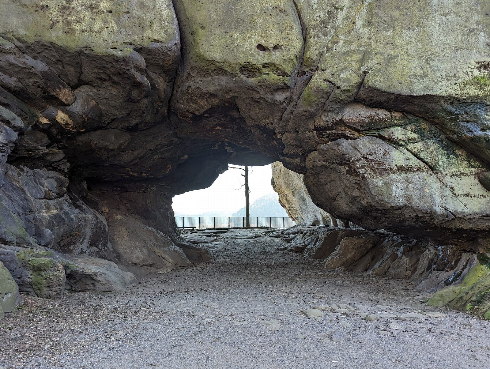
The walk starts at the Lichtenhain waterfall in the Kirnitzsch valley, the terminus of the tramway from Bad Schandau, where there is also a pay car park. It crosses the Kirnitzsch and climbs through forest to the Kuhstall, a rock arch 11 m high and 17 m wide, the second largest in the Elbe Sandstone Mountains, with a railed terrace on its far side looking out over the back country of the park. Beside the arch the Himmelsleiter, a steep, narrow stair through a cleft, climbs to the top of the rock, where the castle of Wildenstein once stood. The way back goes down steps beyond the arch and round by the Hinterer Kuhstallweg to the valley.
It is 3 km with 179 m of ascent; allow about 1¼ hours. The grade is Easy.
The name means cowshed: either local people hid their cattle here in the Thirty Years' War, or the robber knights of the castle kept stolen beasts in it. There is an inn beside the arch.
The Himmelsleiter is too narrow and steep for dogs. The tram runs every half hour from late March to the start of November, and less often in winter. In the national park keep to marked paths; no fires, no drones, dogs on a lead.
Route drawn by Global Adventurer along OpenStreetMap paths (© OpenStreetMap contributors, ODbL), with figures worked out from it. Check the forecast and the ground on the day: paths change.
Good to know
- The Kuhstall is a rock arch 11 m high and 17 m wide, the second largest in the Elbe Sandstone Mountains
- The Himmelsleiter is a steep, narrow stair through a cleft to the top of the rock, where the castle of Wildenstein once stood
- The Kirnitzsch valley tramway runs from Bad Schandau to the start
- In Saxon Switzerland National Park: keep to the marked paths; no fires, no drones, dogs on a lead
Summits on the way
- Glöckner · passed close by
- Glocke · passed close by
- Münzstein · passed close by
- Neuer Wildenstein 337 m · passed close by
- Blasketurm · passed close by
- Hebamme · passed close by
- Hohler Turm · passed close by
- Kuhstallscheibe · passed close by
- Wildensteinwand · passed close by
Getting there
Start: Lichtenhainer Wasserfall · Pay and display. 50.92877, 14.24367
Places to stay nearby
Rooms in and around Saxon Switzerland: Booking.com → Expedia →
Affiliate links: if you book, Global Adventurer earns a small commission at no cost to you.
Paths change, and the weather decides the day. The line and figures come from OpenStreetMap and our own checks; take a map, check the forecast, and turn back if it isn't right.