Line © OpenStreetMap contributors (ODbL), checked by Global Adventurer.
The walk
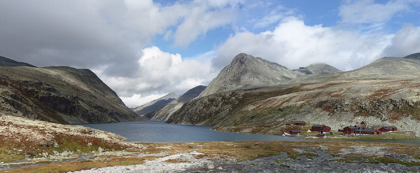
From the car park at Spranget, at the end of the public road from Mysusæter, a gravel road closed to cars runs north for 6 km to Rondvassbu, the trekking association's lodge at the south end of Rondvatnet. Storronden and Rondslottet, among the highest tops in Rondane, rise above the lake. Return the same way.
It is 13.3 km there and back with 119 m of ascent; allow about 3½ hours. The grade is Moderate, for the length: the road is easy and almost level.
DNT says the road takes about 1½ hours on foot each way. Rondvassbu is open from mid-June to mid-September in summer, and in 2026 a boat crossed Rondvatnet every day from 19 June to 23 August, and then at weekends for three weeks. The lodge's self-service rooms closed for good after Easter 2026.
The road from Mysusæter to Spranget has a 10 kr toll. From 5 July 2026 parking at Spranget is not allowed between 11 pm and 6 am; if you stay the night, park at Mysusæter.
Route drawn by Global Adventurer along OpenStreetMap paths (© OpenStreetMap contributors, ODbL), with figures worked out from it. Check the forecast and the ground on the day: paths change.
Good to know
- A gravel road closed to cars runs 6 km from Spranget to the DNT hut Rondvassbu, about 1½ hours on foot
- Rondvassbu stands at the south end of Rondvatnet, under Storronden and Rondslottet
- The road to Spranget has a 10 kr toll; from 5 July 2026 there is no parking at Spranget from 11 pm to 6 am
- In summer a boat crosses Rondvatnet from Rondvassbu
Getting there
Start: Spranget. 61.83502, 9.73108
Places to stay nearby
Rooms in and around Rondane: Booking.com → Expedia →
Affiliate links: if you book, Global Adventurer earns a small commission at no cost to you.
Paths change, and the weather decides the day. The line and figures come from OpenStreetMap and our own checks; take a map, check the forecast, and turn back if it isn't right.