Line © OpenStreetMap contributors (ODbL), checked by Global Adventurer.
The walk
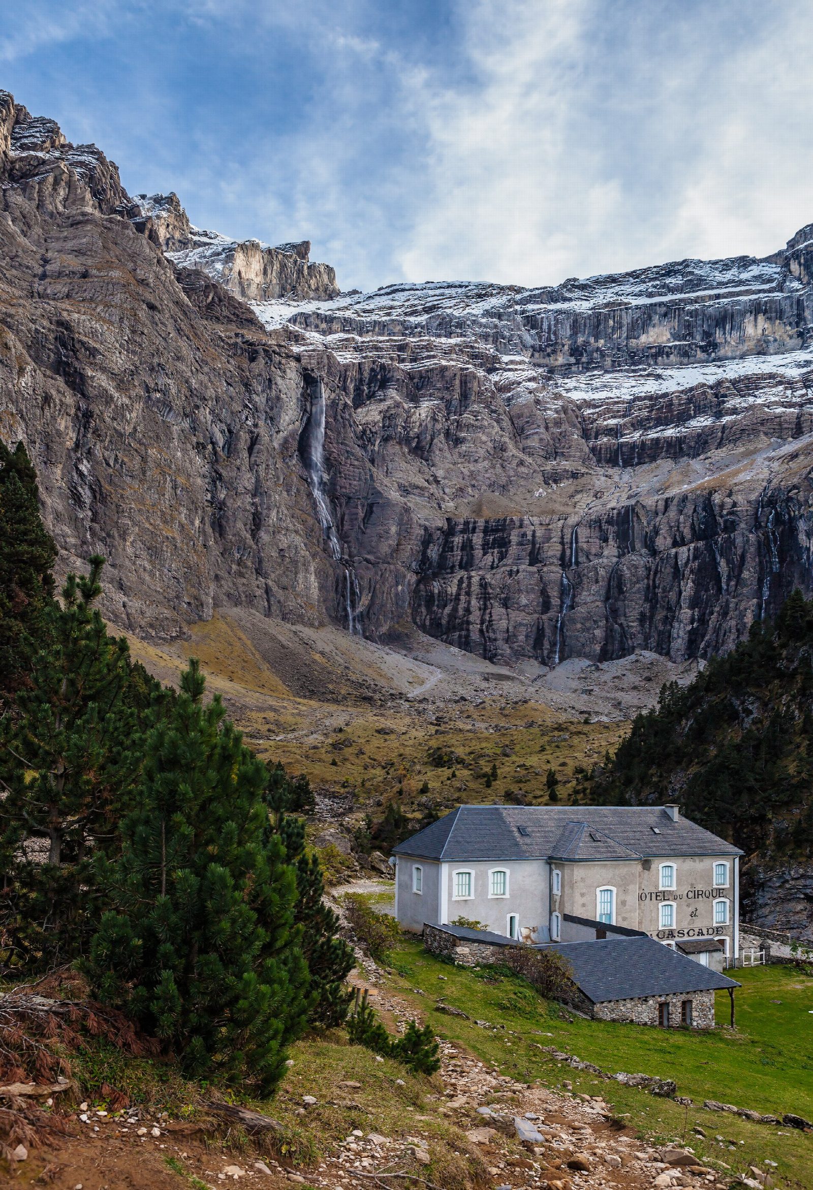
From the car park in Gavarnie village, walk up through the village and follow the broad path up the valley beside the Gave de Gavarnie, through meadows and pine woods and over the Plateau de la Prade. The Cirque grows ahead, a vast amphitheatre of limestone walls and ledges, with the Grande Cascade falling down its back wall. The path ends at the Hôtellerie du Cirque, an old inn at the foot of the walls. Return the same way.
It is 7.4 km there and back with 193 m of ascent; allow about 2½ hours. The grade is Easy: a broad path and track with a steady, gentle climb.
Since 1997 the Cirque has been part of the Pyrénées-Mont Perdu World Heritage Site, listed for both its natural and its cultural value, with the great glacial cirques of Estaubé and Troumouse nearby. Beyond the Hôtellerie a path goes on towards the foot of the waterfall over rough ground with a risk of falling rock, and snow can lie there into summer; this walk stops at the Hôtellerie.
There are pay car parks in Gavarnie village, at the end of the road up the valley from Luz-Saint-Sauveur. In summer the path is busy, so start early.
Route drawn by Global Adventurer along OpenStreetMap paths (© OpenStreetMap contributors, ODbL), with figures worked out from it. Check the forecast and the ground on the day: paths change.
Good to know
- The Cirque de Gavarnie is a vast glacial amphitheatre of limestone walls, with the Grande Cascade falling down its back wall
- Since 1997 it has been part of the Pyrénées-Mont Perdu World Heritage Site, listed for both its natural and its cultural value
- The path follows the Gave de Gavarnie to the Hôtellerie du Cirque at the foot of the walls
Getting there
Start: Gavarnie village car park. 42.73277, -0.00895
Places to stay nearby
Rooms in and around Pyrenees: Booking.com → Expedia →
Affiliate links: if you book, Global Adventurer earns a small commission at no cost to you.
Paths change, and the weather decides the day. The line and figures come from OpenStreetMap and our own checks; take a map, check the forecast, and turn back if it isn't right.