Line © OpenStreetMap contributors (ODbL), checked by Global Adventurer.
The walk
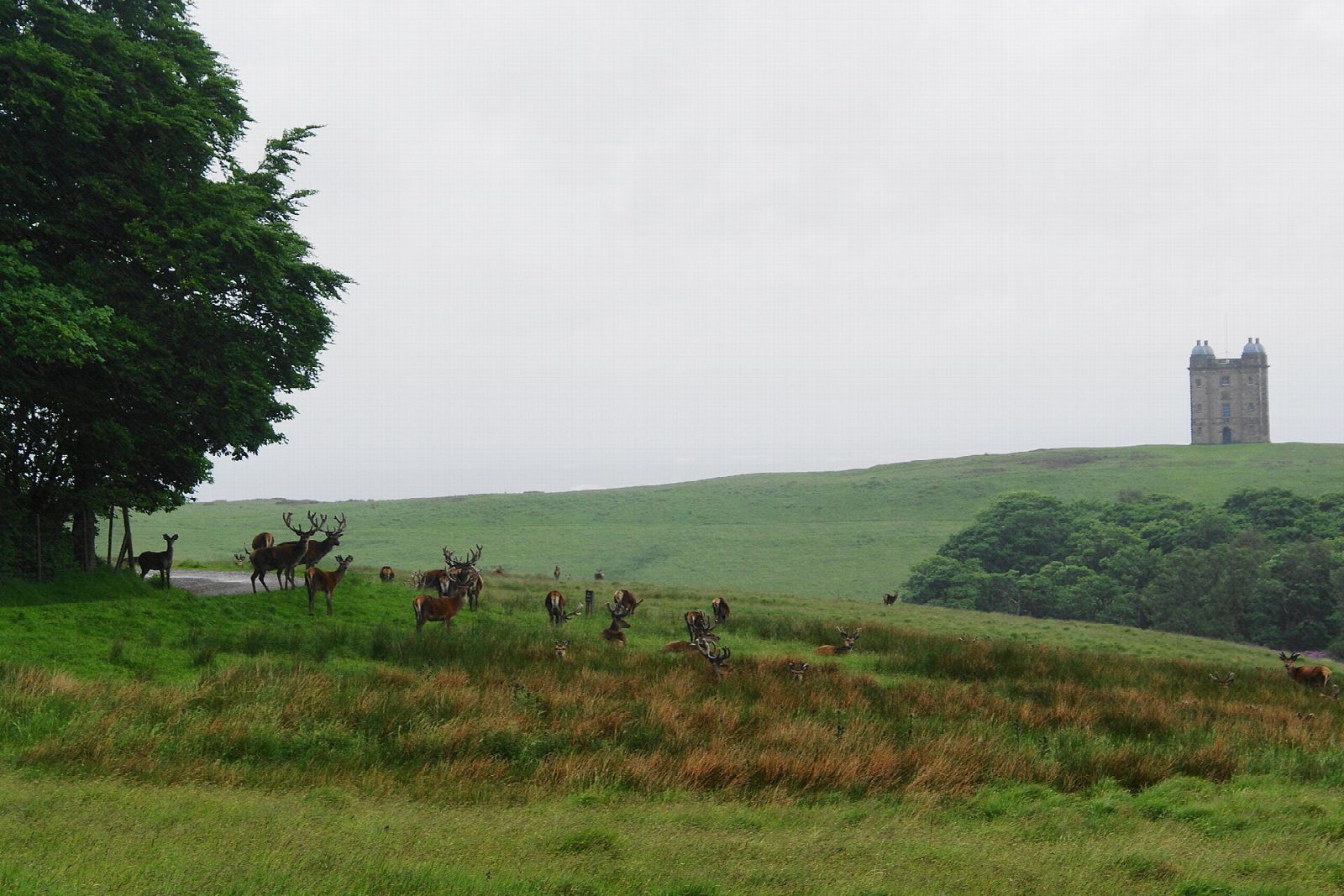
The walk starts from the main car park at Lyme, below the house. It climbs past the front of the house to the Cage, the hunting tower on the ridge to the north, then crosses the park and the east drive to Lantern Wood, where the Lantern, a small stone tower, stands among the trees. A path follows the wall up over the moor to the Bowstones, a pair of Anglian cross shafts beside the ridge road at the park's edge. The return is west along the Gritstone Trail, down across Park Moor to Knightslow Wood, and through the wood to the car park.
It is 5.4 km with 217 m of ascent; allow about 2 hours. The grade is Easy: short, but it climbs to 400 m on open moor.
The moorland paths are rough and wet in places. Red deer live in the park and the stags rut in autumn: keep to the paths and keep your distance. Dogs must be on a short lead except in the marked off-lead areas. From the Lantern and the Bowstones the view runs from Kinder Scout to the Cheshire plain.
The National Trust charges for entry to the park, and the gates close in the evening; members go in free. Disley station is about 2.5 km from the car park, and visitors who arrive by train are let in free.
Route drawn by Global Adventurer along OpenStreetMap paths (© OpenStreetMap contributors, ODbL), with figures worked out from it. Check the forecast and the ground on the day: paths change.
Good to know
- The Cage is a hunting tower of about 1580, rebuilt in 1737
- The Bowstones are a pair of Anglian cross shafts
- Lyme's deer park covers about 550 hectares and holds red deer
- The Legh family owned Lyme for 600 years and gave it to the National Trust in 1946
Summits on the way
- Higher Moor 402 m · passed close by
Getting there
Start: Lyme Park car park · Pay and display. 53.33804, -2.05720
By train: Disley station is 2.4 km from the start.
Places to stay nearby
Rooms in and around Disley: Booking.com → Expedia →
Affiliate links: if you book, Global Adventurer earns a small commission at no cost to you.
Paths change, and the weather decides the day. The line and figures come from OpenStreetMap and our own checks; take a map, check the forecast, and turn back if it isn't right.


