Line © OpenStreetMap contributors (ODbL), checked by Global Adventurer.
The walk
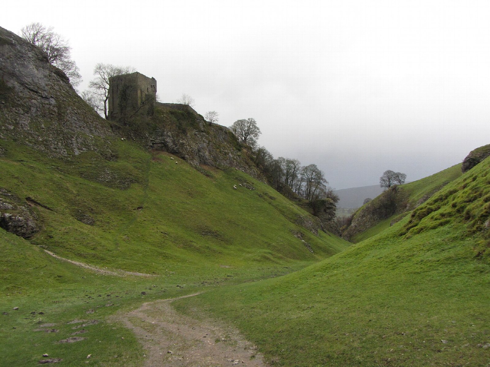
The walk starts from the main car park by the visitor centre in Castleton. It crosses the village to the narrow entrance of Cave Dale and climbs the dale on the Limestone Way, under the keep of Peveril Castle. From the top a path leads west over the pastures to the lane by Rowter Farm, which is followed north to the road; a path carries on by Windy Knoll and round to Winnats Head. The return is down the Winnats Pass, between limestone pinnacles, to Speedwell Cavern, then by a field path under the hillside to Goosehill and the village.
It is 7.8 km with 265 m of ascent; allow about 2½ hours. The grade is Easy: short, with one steady climb.
Cave Dale is steep at first, rocky and slippery when wet, and the wind funnels through it; it is about 1.2 km long with walls over 50 metres high. Peveril Castle was founded soon after 1066, and Henry II built the keep about 1174. The Winnats road is narrow and steep, with a gradient of more than 28%: keep to the grass beside it and watch for traffic. Sheep and cattle graze the pastures.
The High Peak Borough Council car park charges and has toilets. Hope station is about 3 km away.
Route drawn by Global Adventurer along OpenStreetMap paths (© OpenStreetMap contributors, ODbL), with figures worked out from it. Check the forecast and the ground on the day: paths change.
Good to know
- Cave Dale is a dry limestone ravine about 1.2 km long with walls over 50 metres high
- Peveril Castle, founded soon after 1066, stands above the dale; Henry II built the keep about 1174
- The Winnats Pass is a limestone gorge with a gradient of more than 28%
- Passes Speedwell Cavern at the foot of the pass
Getting there
Start: Castleton car park · Pay and display. 53.34389, -1.77749
Places to stay nearby
Rooms in and around Hope: Booking.com → Expedia →
Affiliate links: if you book, Global Adventurer earns a small commission at no cost to you.
Paths change, and the weather decides the day. The line and figures come from OpenStreetMap and our own checks; take a map, check the forecast, and turn back if it isn't right.
