Line © OpenStreetMap contributors (ODbL), checked by Global Adventurer.
The hike
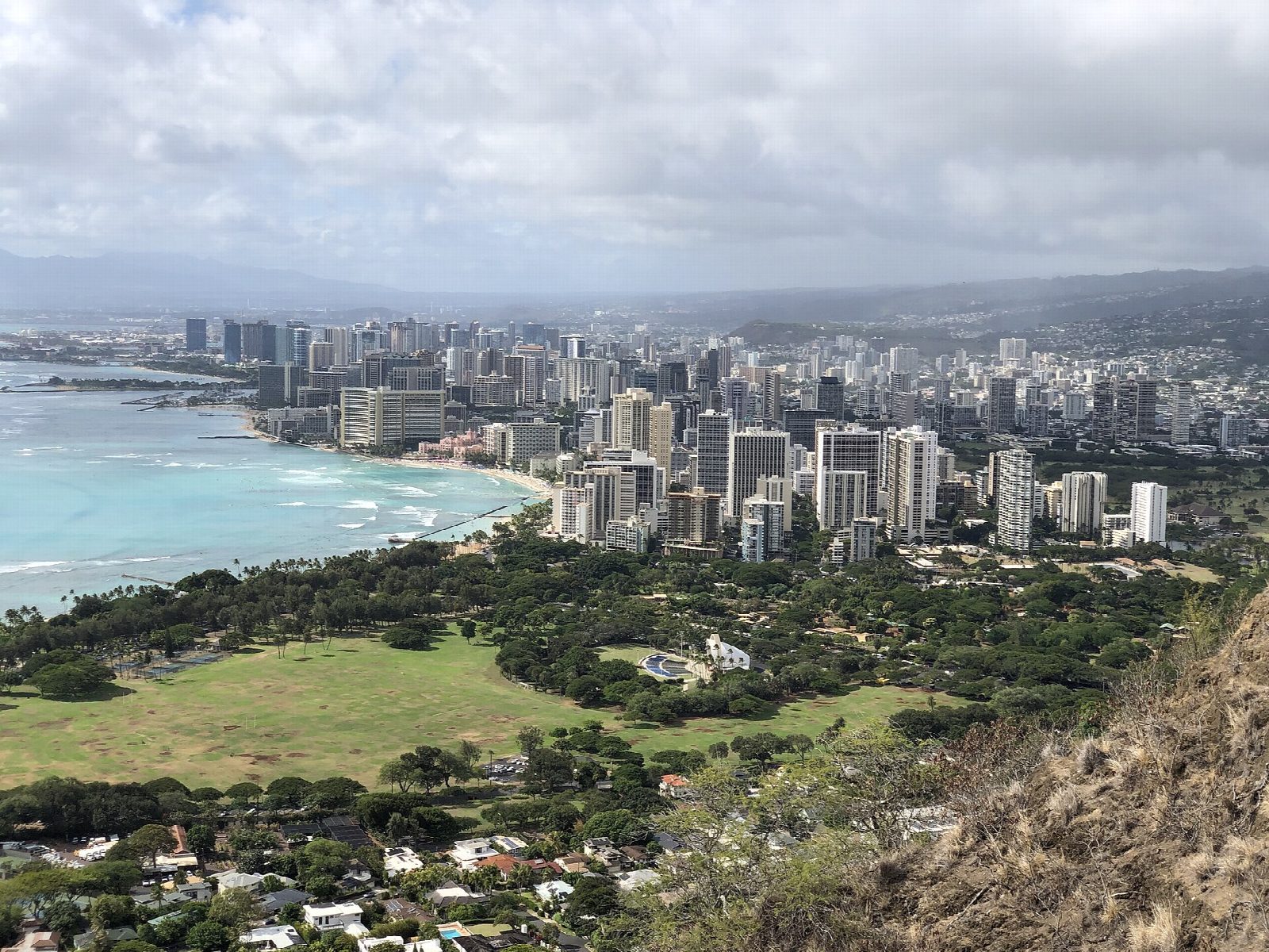
The walk starts at the car park on the crater floor of Diamond Head State Monument, reached through a road tunnel from Diamond Head Road. A concrete path crosses the crater floor, and the trail of 1908 climbs the inner wall in switchbacks to a lookout. A stairway of 74 steps leads to a lit tunnel 225 feet long, and a second of 99 steps to the Fire Control Station, where a spiral staircase climbs inside the old lookout. Metal stairs reach the summit, with Waikīkī and Honolulu below. A short loop along the rim leads back to the tunnel; then return the way you came.
It is 1.9 miles (3.0 km) round trip with 630 feet (192 m) of climbing; allow about 1½ hours. The grade is Easy: short and on a made path, but steep, and all stairs near the top.
Visitors who are not Hawaii residents must book entry before they come, and parking if they drive: slots open 30 days ahead on the State Parks booking site, and nobody is let in without a reservation. Entry is $5 a person and parking $10 a vehicle, by card only.
The park is open from 6 am to 6 pm, with last entry at 4:30 pm. The trail is hot and has no shade, so go early and carry water.
Route drawn by Global Adventurer along OpenStreetMap paths (© OpenStreetMap contributors, ODbL), with figures worked out from it. Check the forecast and the ground on the day: paths change.
Good to know
- Non-residents must book entry and parking online in advance; Hawaii residents get in free with ID
- Switchbacks, stairs and a 225-foot tunnel lead up to a 1900s fire-control station on the crater rim
- Open 6 am to 6 pm, last entry 4:30 pm; the trail is hot and shadeless by midday, so go early and carry water
Summits on the way
- Diamond Head 761 ft (232 m)
Getting there
Start: Diamond Head State Monument car park. 21.26326, -157.80459
Places to stay nearby
Rooms in and around Oahu: Booking.com → Expedia →
Affiliate links: if you book, Global Adventurer earns a small commission at no cost to you.
Paths change, and the weather decides the day. The line and figures come from OpenStreetMap and our own checks; take a map, check the forecast, and turn back if it isn't right.