Line © OpenStreetMap contributors (ODbL), checked by Global Adventurer.
The walk
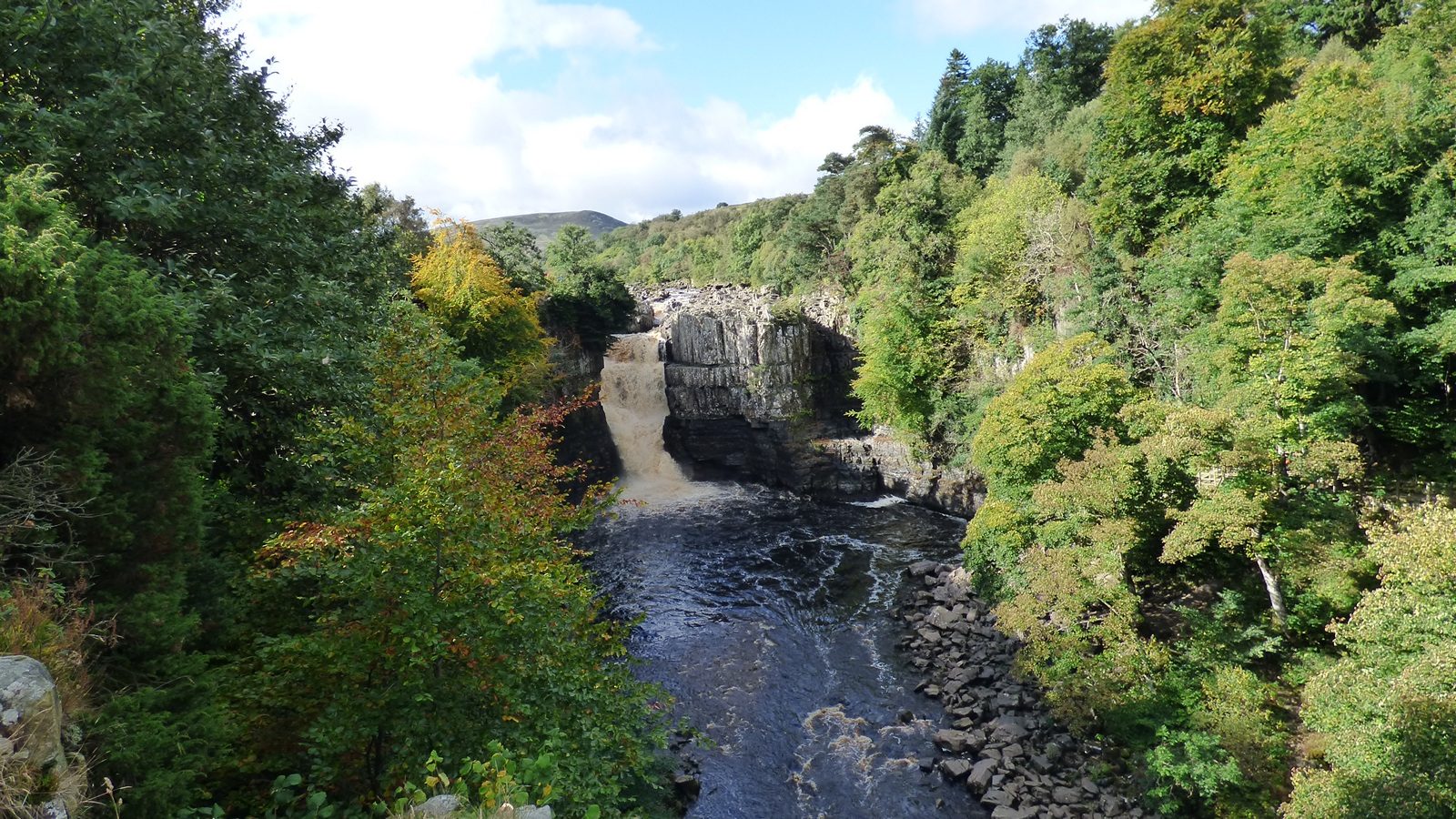
From the Bowlees visitor centre the walk climbs over Hare Hill and crosses the fields and farm tracks above the north side of Teesdale, past Ettersgill, to Cronkley Bridge. It crosses the Tees and joins the Pennine Way, which follows the river downstream on the south bank past Bleabeck Force to the top of High Force, where the whole river drops 21 m over the Whin Sill. It goes on past Keedholm Scar to the falls of Low Force and crosses Wynch Bridge, one of the oldest suspension bridges in England, back to Bowlees.
It is 13.5 km with 297 m of ascent; allow about 4 hours. The grade is Moderate. Most of it is on field paths and the riverside Pennine Way.
The riverside path is rocky in places and the falls have sheer drops: keep children close. The upland meadows are full of flowers in early summer; keep to the paths and close gates. Sheep and cattle graze the fields, so keep dogs on leads.
The Bowlees visitor centre car park asks for a donation. There is no station near; the nearest is Appleby, about 23 km away.
Route drawn by Global Adventurer along OpenStreetMap paths (© OpenStreetMap contributors, ODbL), with figures worked out from it. Check the forecast and the ground on the day: paths change.
Good to know
- Over Hare Hill and across the fields above Teesdale to Cronkley Bridge
- Down the Pennine Way past Bleabeck Force to High Force
- On past Low Force to Wynch Bridge, one of the oldest suspension bridges in England
- High Force drops 21 m over the Whin Sill
Summits on the way
- Hare Hill 356 m · passed close by
Getting there
Start: Bowlees visitor centre car park. 54.64944, -2.14423
Places to stay nearby
Rooms in and around Appleby: Booking.com → Expedia →
Affiliate links: if you book, Global Adventurer earns a small commission at no cost to you.
Paths change, and the weather decides the day. The line and figures come from OpenStreetMap and our own checks; take a map, check the forecast, and turn back if it isn't right.
