Line © OpenStreetMap contributors (ODbL), checked by Global Adventurer.
The walk
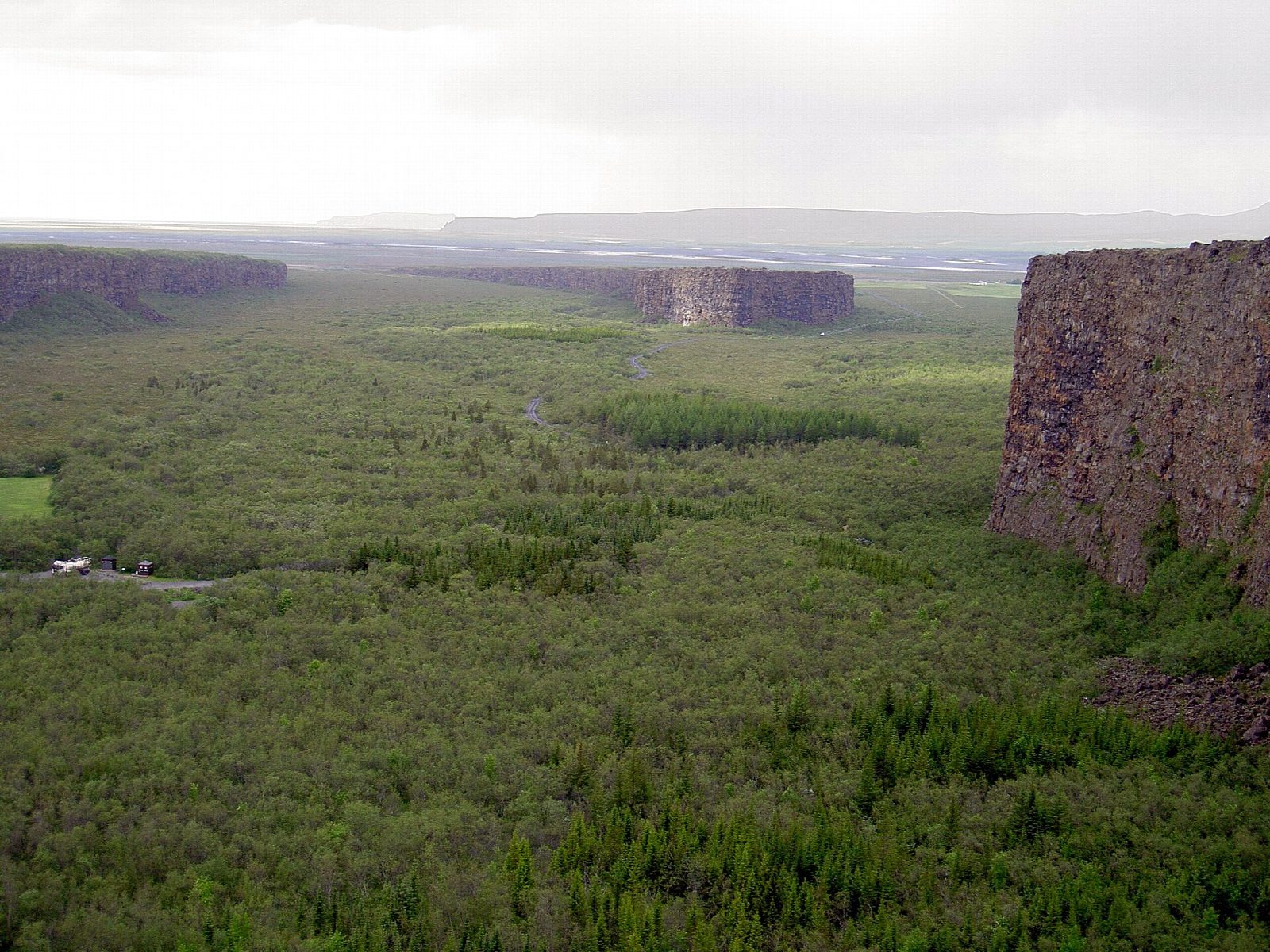
From the car park at Gljúfrastofa, the national park visitor centre, take the path south-west to the campsite, then the path north-west across the canyon floor to the northern tip of Eyjan (the Island), the rock ridge that splits Ásbyrgi down the middle. Steps lead up onto it. Walk south along the top of Eyjan to the viewpoint at its far end, take the short loop round the end and back along its west edge, then return the same way.
It is 6.2 km there and back with 157 m of ascent; allow about 2 hours. The grade is Easy: level paths on the canyon floor, then steps up onto Eyjan and a path along its top.
Eyjan has high, unfenced cliffs on both sides, so keep away from the edges. The paths can be icy in winter. Ásbyrgi is a horseshoe-shaped canyon about 3.5 km long, with cliffs up to 100 m high. Huge glacial floods on the Jökulsá á Fjöllum carved it before the river moved east; folklore says it is the hoofprint of Sleipnir, Odin's eight-legged horse.
Parking at Gljúfrastofa is free: Vatnajökull National Park charges for parking only at Skaftafell and Jökulsárlón. There is drinking water by the campsite. We found no winter bus to Ásbyrgi; Strætó route 79 runs from Akureyri to Húsavík, about 65 km away by road 85.
Route drawn by Global Adventurer along OpenStreetMap paths (© OpenStreetMap contributors, ODbL), with figures worked out from it. Check the forecast and the ground on the day: paths change.
Good to know
- Ásbyrgi is a horseshoe-shaped canyon about 3.5 km long with cliffs up to 100 m high
- Huge glacial floods on the Jökulsá á Fjöllum carved it before the river moved east
- Folklore says it is the hoofprint of Sleipnir, Odin's eight-legged horse
- Eyjan, the Island, is the rock ridge that splits the canyon down the middle
Getting there
Start: Gljúfrastofa visitor centre car park. 66.02845, -16.48846
Places to stay nearby
Rooms in and around North Iceland: Booking.com → Expedia →
Affiliate links: if you book, Global Adventurer earns a small commission at no cost to you.
Paths change, and the weather decides the day. The line and figures come from OpenStreetMap and our own checks; take a map, check the forecast, and turn back if it isn't right.