Line © OpenStreetMap contributors (ODbL), checked by Global Adventurer.
The hike
The walk starts at the Park Butte Trailhead at the end of Forest Road 13, on the south side of Mount Baker. The Park Butte Trail crosses Schriebers Meadow, then the bouldery channels of Rocky Creek, where a bridge is put in for the summer. It climbs through forest to Morovitz Meadow and the junction with the Railroad Grade Trail, then goes on up past small tarns to the lookout on Park Butte, built in 1932. Return the same way.
It is 7.6 miles (12.2 km) round trip with 1,950 feet (593 m) of climbing; allow about 4½ hours. The grade is Moderate: a steady climb, with one awkward creek crossing.
The bridge over Rocky Creek is taken out each year from early fall until spring, and without it the crossing can be difficult. This is a very fragile area: human waste must be packed out, camping is not allowed at the tarns beside the trail, and groups are limited to 12 people.
A Northwest Forest Pass or an America the Beautiful pass is needed to park. The trailhead is 9 miles up Forest Roads 12 and 13 from Baker Lake Road, has room for about 40 cars, and has a toilet. The forest roads are not plowed, so this is a walk for summer and early fall.
Route drawn by Global Adventurer along OpenStreetMap paths (© OpenStreetMap contributors, ODbL), with figures worked out from it. Check the forecast and the ground on the day: paths change.
Good to know
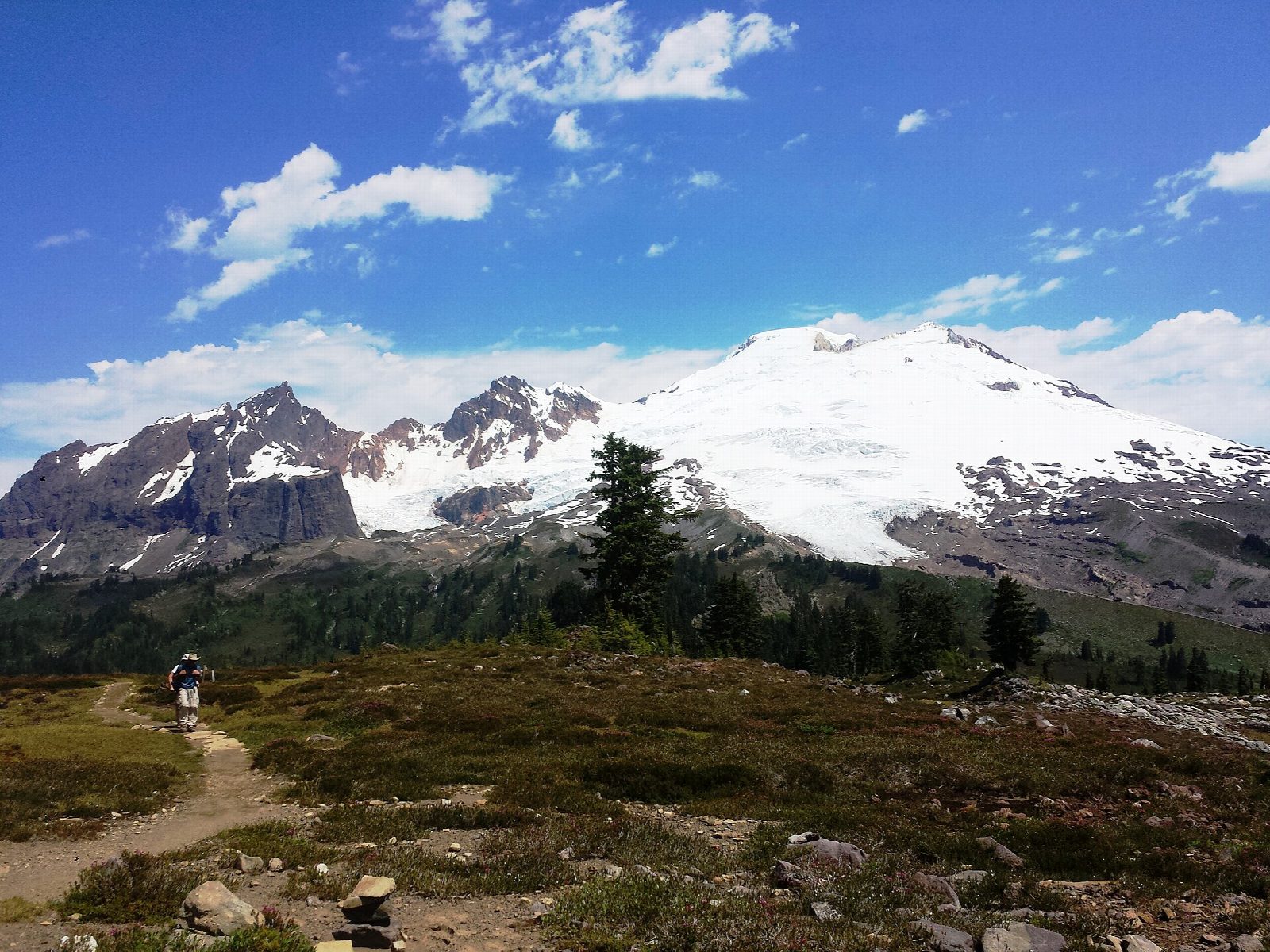
- A 1932 fire lookout looking straight up at the Easton Glacier on Mount Baker
- Through Schriebers and Morovitz Meadows; a seasonal footbridge is removed each autumn
- Human waste must be packed out; a Northwest Forest Pass is needed
Summits on the way
- Park Butte 5,384 ft (1,641 m)
Getting there
Start: Park Butte Trailhead, Schriebers Meadow. 48.70666, -121.81124
Places to stay nearby
Rooms in and around Park Butte Trailhead: Booking.com → Expedia →
Affiliate links: if you book, Global Adventurer earns a small commission at no cost to you.
Paths change, and the weather decides the day. The line and figures come from OpenStreetMap and our own checks; take a map, check the forecast, and turn back if it isn't right.
