Line © OpenStreetMap contributors (ODbL), checked by Global Adventurer.
The walk
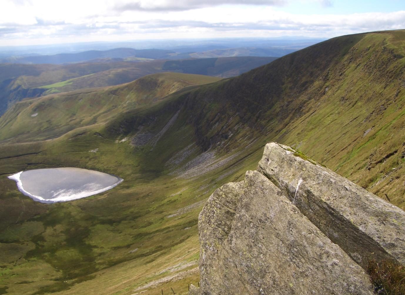
The walk starts from the car park at Tan-y-pistyll, at the foot of Pistyll Rhaeadr. After a look at the fall, take the path east and then north up the valley of the Nant y Llyn to Llyn Lluncaws, a small lake under the cliffs. From the lake a path climbs steeply up the ridge on its left-hand side to the edge of the summit plateau and turns right to the rocky top of Cadair Berwyn, 832 m, the highest point of the range. Return along the edge and continue south-west over Moel Sych, 827 m, then down the long grassy ridge of Trum Felen to the top of the waterfall, where a steep path drops through the trees to the car park.
It is 7.4 km with 554 m of ascent; allow about 4 hours. The grade is Moderate.
These are remote hills with faint paths in places, and they need navigation skill: take a map and compass. The Berwyn is boggy. The edge above the lake has steep drops, and the last descent beside the fall is very steep and can be slippery. There is no phone signal to rely on.
The car park at the falls charges, and there is a café; a little free parking lies on the road below. The lane from Llanrhaeadr-ym-Mochnant is four miles of single track. There is no public transport.
Route drawn by Global Adventurer along OpenStreetMap paths (© OpenStreetMap contributors, ODbL), with figures worked out from it. Check the forecast and the ground on the day: paths change.
Good to know
- Pistyll Rhaeadr falls about 73 m in three stages, under a natural arch of rock
- Cadair Berwyn, 832 m, is the highest summit in Wales outside the National Parks
- Its true top, south of the trig point, was recognised only in 1987
- Llyn Lluncaws lies in a glacial cwm under the cliffs of Moel Sych
Summits on the way
- Cadair Berwyn 832 m
- Moel Sych 827 m
- Trum Felen 691 m · passed close by
Getting there
Start: Tan-y-pistyll, Pistyll Rhaeadr · Pay and display. 52.85498, -3.37686
Places to stay nearby
Rooms in and around Tan-y-pistyll: Booking.com → Expedia →
Affiliate links: if you book, Global Adventurer earns a small commission at no cost to you.
Paths change, and the weather decides the day. The line and figures come from OpenStreetMap and our own checks; take a map, check the forecast, and turn back if it isn't right.