Line © OpenStreetMap contributors (ODbL), checked by Global Adventurer.
The walk
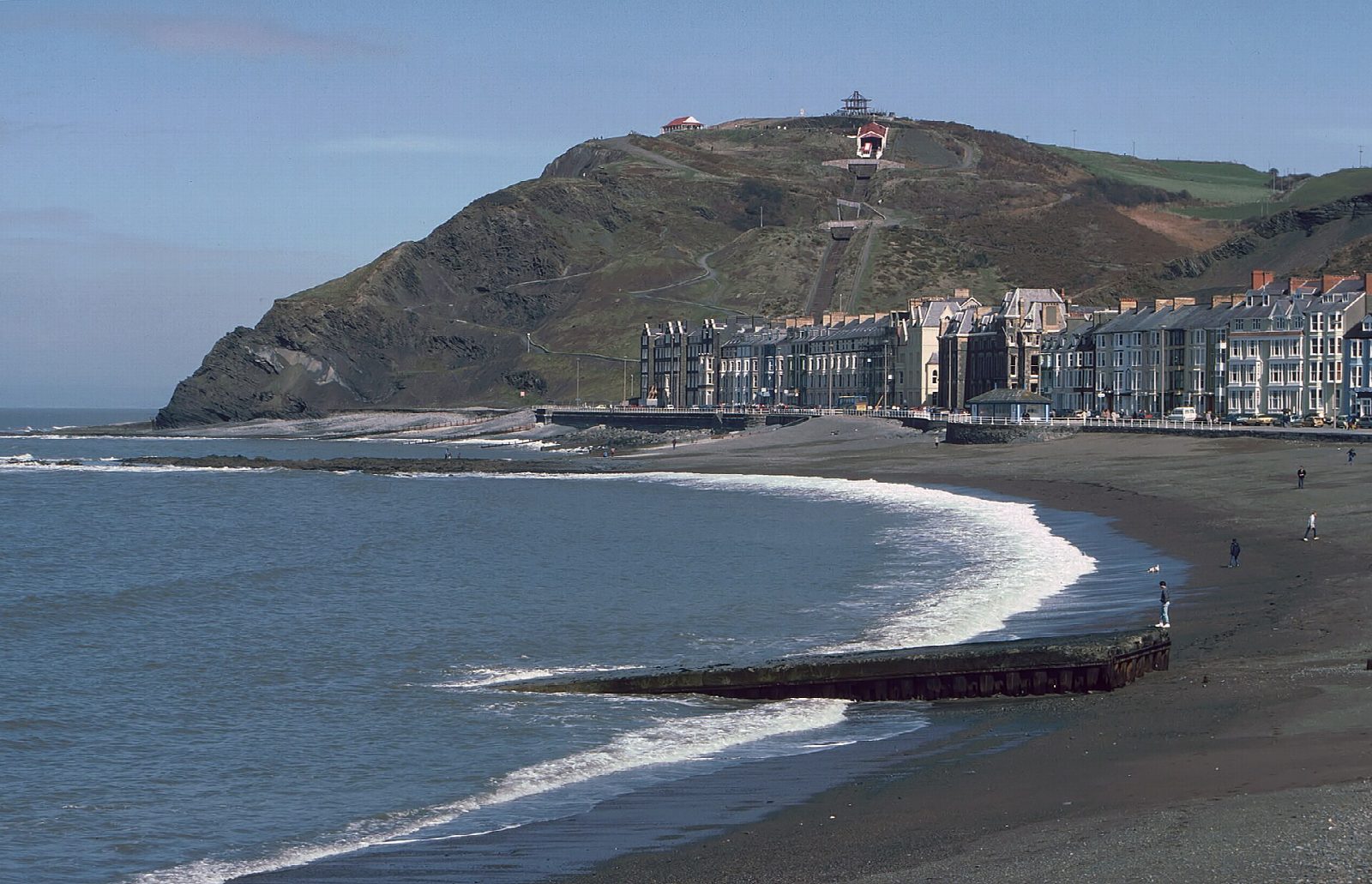
The walk starts from Aberystwyth station. Go through the town to the promenade and along it to the north end, then climb the path up Constitution Hill, beside the cliff railway. The Ceredigion Coast Path drops to Clarach Bay, crosses the stream by the beach and climbs back onto the cliffs. It follows them north to Wallog, where the shingle spit of Sarn Gynfelyn runs out into Cardigan Bay, then rises and falls over a line of high cliffs before the last descent, past the war memorial, into Borth. Follow the seafront through the village to the station, and take the train back.
It is 10.8 km with 368 m of ascent; allow about 3¾ hours. The grade is Moderate.
There are steep climbs and descents throughout. The cliffs are soft and eroding, worst between Clarach and Wallog, where the path runs close to the edge: keep to the path and the fence line, where it has been moved back. It is not a walk for those who dislike heights, or for a day of strong wind. There is no way off the cliffs between Clarach and Borth.
Trains on the Cambrian line link Borth and Aberystwyth, and buses run between them too. Both have car parks, cafés and toilets.
Route drawn by Global Adventurer along OpenStreetMap paths (© OpenStreetMap contributors, ODbL), with figures worked out from it. Check the forecast and the ground on the day: paths change.
Good to know
- Railway stations at both ends, at Aberystwyth and Borth
- Over Constitution Hill, which has a cliff railway, and down to Clarach Bay
- At Wallog the shingle spit of Sarn Gynfelyn runs out to sea
- The cliffs are soft and eroding: the path has been moved back in places
Summits on the way
- Constitution Hill 131 m · passed close by
Getting there
Start: Aberystwyth station. 52.41380, -4.08082
By train: Aberystwyth station is 0.1 km from the start.
Places to stay nearby
Rooms in and around Aberystwyth: Booking.com → Expedia →
Affiliate links: if you book, Global Adventurer earns a small commission at no cost to you.
Paths change, and the weather decides the day. The line and figures come from OpenStreetMap and our own checks; take a map, check the forecast, and turn back if it isn't right.