Line © OpenStreetMap contributors (ODbL), checked by Global Adventurer.
The hike
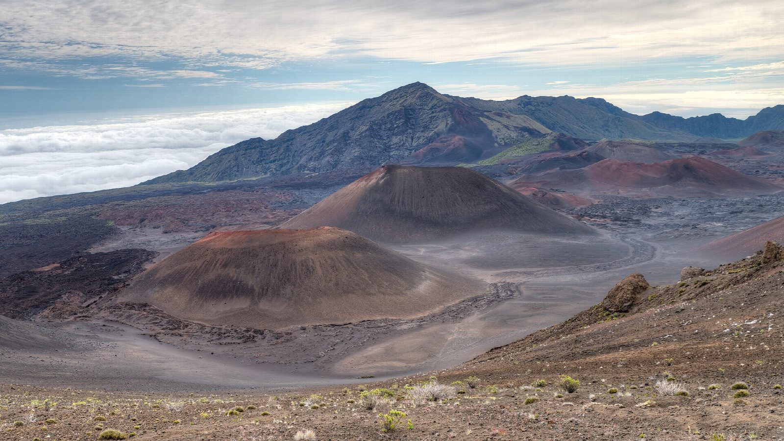
The walk starts at the Haleakalā Visitor Center parking lot, near the top of Haleakalā at about 9,740 feet. The Keoneheʻeheʻe Trail, also called Sliding Sands, begins beside the road, passes below the hill of Pā Kaʻoao, and then drops in long sweeps down open slopes of red, grey and black cinder into the crater. Our line goes on to about 8,500 feet, level with Ka Luʻu o ka ʻŌʻō, a cinder cone on the north side of the trail, and turns back there, with the crater floor still far below. Return the same way.
It is 4.1 miles (6.6 km) round trip with 1,190 feet (364 m) of climbing; allow about 3 hours. The grade is Moderate: a good path, but high, and every foot of climbing comes on the way back.
The park says to allow twice as long to climb out as to walk in. The air is thin, and altitude sickness and hypothermia are real risks; the sun is harsh, and cold, wind and rain can come at any time of year. Carry water and food, as there is none on the trail, and stay on the marked path.
The park charges $30 a vehicle, valid for three days and paid by card. Driving in between 3 and 7 am for the sunrise needs a reservation; a daytime visit does not.
Route drawn by Global Adventurer along OpenStreetMap paths (© OpenStreetMap contributors, ODbL), with figures worked out from it. Check the forecast and the ground on the day: paths change.
Good to know
- Down the Keoneheʻeheʻe Trail through red and black cinders towards the crater floor
- Starts near 9,740 feet: the thin air makes the climb back out slow, so allow twice as long
- Driving up for sunrise (3 to 7 am) needs a reservation; daytime hiking does not
Getting there
Start: Keoneheʻeheʻe Trailhead, Haleakalā Visitor Center · Free parking. 20.71474, -156.25057
Places to stay nearby
Rooms in and around Keoneheʻeheʻe Trailhead: Booking.com → Expedia →
Affiliate links: if you book, Global Adventurer earns a small commission at no cost to you.
Paths change, and the weather decides the day. The line and figures come from OpenStreetMap and our own checks; take a map, check the forecast, and turn back if it isn't right.
