Line © OpenStreetMap contributors (ODbL), checked by Global Adventurer.
The walk
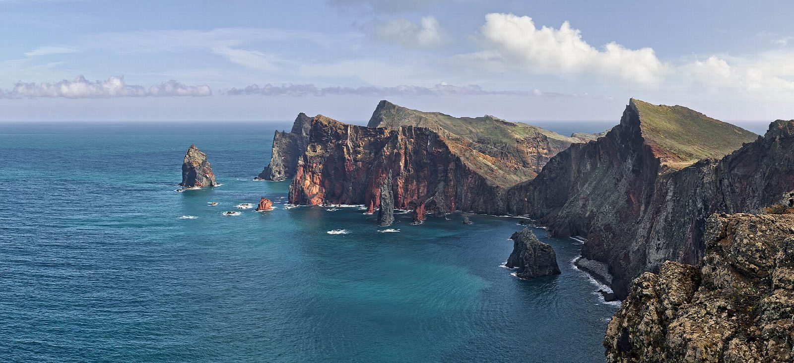
From the car park at the end of the road beyond Caniçal, go down the steps and boardwalk and follow the path east above Baía d'Abra. It climbs to the narrow neck of the peninsula, where a lookout gives a view down the north cliffs, then runs east along the bare spine of the headland. After a last rise it drops to Casa do Sardinha, a farmhouse in a palm grove with a café. Return the same way.
It is 6.3 km there and back with 142 m of ascent; allow about 2 hours. The grade is Easy: a clear path with steps and a few steep, loose stretches.
Every walker must book a 30-minute entry slot on the Madeira government's SIMplifica portal; visitors aged 13 and over pay €4.50 a trail, or €9 for two or more trails on the same day. The path on from Casa do Sardinha to Pico do Furado is closed. There is no shade, the wind is often strong and sheer cliff edges come close to the path: keep back, and carry water and sun protection.
No fee is known for the car park. SAM bus 113 runs from Funchal through Machico and Caniçal to a stop at the car park, between about hourly and every few hours; check the timetable.
Route drawn by Global Adventurer along OpenStreetMap paths (© OpenStreetMap contributors, ODbL), with figures worked out from it. Check the forecast and the ground on the day: paths change.
Good to know
- The bare volcanic peninsula at Madeira's eastern tip, with sheer cliffs on the north side and quieter bays to the south
- Wind and low rainfall keep it almost treeless, unlike the green interior of the island
- Casa do Sardinha, an old farmhouse in a palm grove, is used by the nature wardens and has a café
- The climb beyond Casa do Sardinha to Pico do Furado is closed, so the walk turns at the house
Getting there
Start: Baía d'Abra car park. 32.74305, -16.70149
Places to stay nearby
Rooms in and around Madeira: Booking.com → Expedia →
Affiliate links: if you book, Global Adventurer earns a small commission at no cost to you.
Paths change, and the weather decides the day. The line and figures come from OpenStreetMap and our own checks; take a map, check the forecast, and turn back if it isn't right.