Line © OpenStreetMap contributors (ODbL), checked by Global Adventurer.
The walk
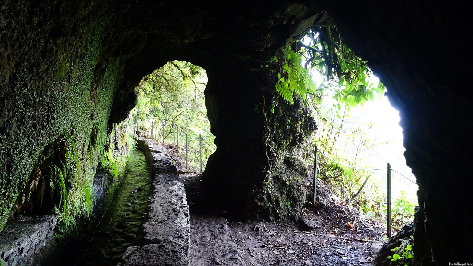
From the thatched houses at Queimadas, follow the Levada do Caldeirão Verde west into the laurel forest. The path winds in and out of side valleys and through four short rock tunnels. After the last one it turns south-west into the deep, green bowl of Caldeirão Verde, where a short spur on the left leads to the pool below a waterfall about 100 m high. Return the same way.
It is 12 km there and back with 93 m of ascent; allow about 4½ hours. The grade is Moderate: the levada is almost level, but the path is long and narrow, with drops on the open side. The climb and the time are Lido Tours' published figures.
Every walker must book a 30-minute entry slot on the Madeira government's SIMplifica portal; visitors aged 13 and over pay €4.50 a trail, or €9 for two or more trails on the same day. Railings guard only some of the drops; stones are slippery, there is mud and rocks can fall. Some tunnels are low: carry a torch. The forestry service asks for extra care because of erosion.
The car park at Queimadas costs €2 an hour. No bus goes up there: buses from Funchal reach Santana, several kilometres below by a narrow road, so take a taxi or walk up.
Route drawn by Global Adventurer along OpenStreetMap paths (© OpenStreetMap contributors, ODbL), with the distance and time worked out from it. The climb is the published figure: height data cannot be trusted on this ground. Check the forecast and the ground on the day: paths change.
Good to know
- The levada was dug in the 18th century to carry mountain water to the farms around Faial
- It runs through the laurel forest (Laurissilva), a UNESCO World Heritage Site
- Four short tunnels cut through the rock: carry a torch
- At the end a waterfall drops about 100 m down a mossy cliff into the Caldeirão Verde pool
Getting there
Start: Queimadas forest park car park. 32.78423, -16.90569
Places to stay nearby
Rooms in and around Madeira: Booking.com → Expedia →
Affiliate links: if you book, Global Adventurer earns a small commission at no cost to you.
Paths change, and the weather decides the day. The line and figures come from OpenStreetMap and our own checks; take a map, check the forecast, and turn back if it isn't right.