Line © OpenStreetMap contributors (ODbL), checked by Global Adventurer.
The walk
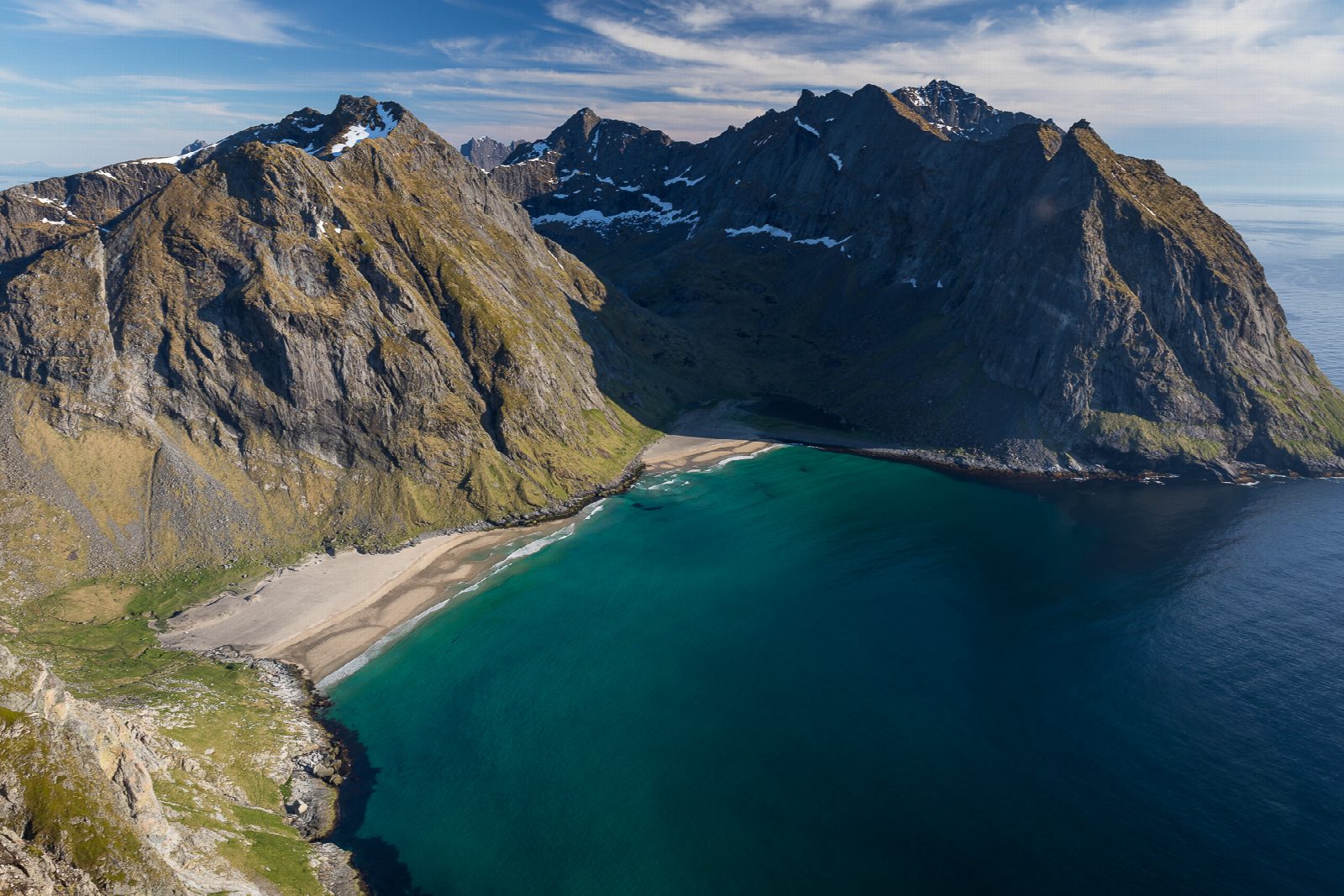
From the car park at Innersand, near Fredvang, a path laid with boardwalk crosses the wet ground and climbs to Einangen, then more steeply to the saddle at Skjettendikan. A short level stretch leads to the last climb to the top of Ryten, 543 m; many stop at the well-known rock just below the summit, where the view of Kvalvika is best. Back at Skjettendikan, turn west past Forsvatnet and down the slope to the beach at Kvalvika. From the beach the path climbs over the pass towards Torsfjorden, and a path leads north back to Innersand.
It is 11 km round with 820 m of ascent; allow about 6 hours. The grade is Hard: two steep climbs and descents on rough paths.
Lofoten Friluftsråd gives the season as May to September and says neither path is signed or marked, though both are clear on the ground. From Kvalvika it suggests going back the way you came, or crossing to Torsfjorden for the shuttle bus or a 3.1 km walk along the road; our line comes back on a path instead.
Parking at Innersand costs 100 kr a car or camper and has a toilet, drinking water and bins. There is a large car park at the old school in Fredvang, which adds 2 km.
Route drawn by Global Adventurer along OpenStreetMap paths (© OpenStreetMap contributors, ODbL), with figures worked out from it. Check the forecast and the ground on the day: paths change.
Good to know
- Ryten, 543 m, looks straight down on the beach at Kvalvika
- Down to Kvalvika and out over the pass to the Torsfjorden road
- The paths are not signed or marked but are clear on the ground
- Parking at Innersand costs 100 kr and has a toilet and water; a larger car park at the old school in Fredvang adds 2 km
Summits on the way
- Ryten 543 m
Getting there
Start: Innersand, Fredvang · Pay and display. 68.08893, 13.13825
Places to stay nearby
Rooms in and around Innersand: Booking.com → Expedia →
Affiliate links: if you book, Global Adventurer earns a small commission at no cost to you.
Paths change, and the weather decides the day. The line and figures come from OpenStreetMap and our own checks; take a map, check the forecast, and turn back if it isn't right.