Line © OpenStreetMap contributors (ODbL), checked by Global Adventurer.
The walk
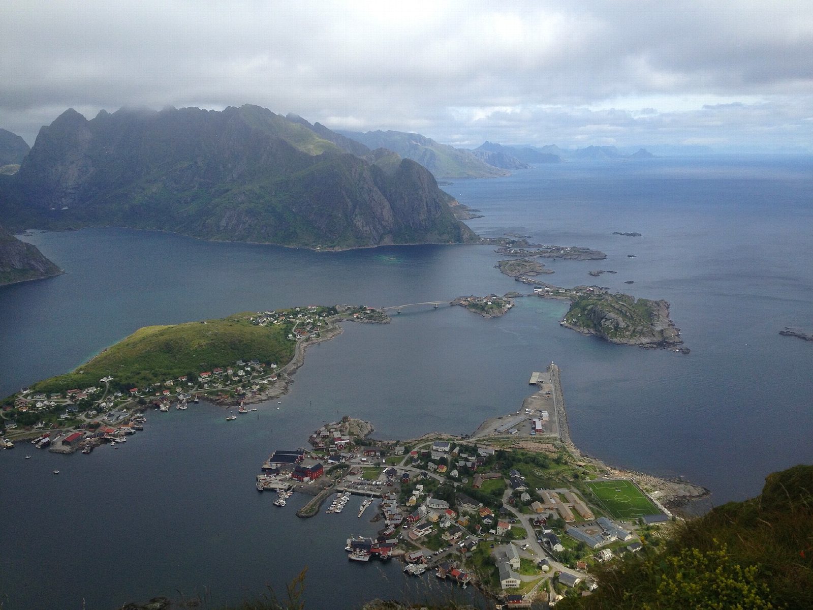
From the car park at Reine ytre havn, walk through the village and along the E10 towards Å, then take the old road round the outside of the tunnel to the foot of the climb. From there a stone stairway laid by Sherpas climbs 448 m without a break up the steep mountainside to the top, looking down on Reine and the Reinefjorden. Return the same way.
It is 5.9 km there and back with 482 m of ascent; allow about 3½ hours. The grade is Moderate: short, but steep and hard work all the way up.
Lofoten Friluftsråd, which publishes the route, gives the season as May to September, says it is not a winter walk and strongly advises against going outside the summer months. It does not recommend the walk for families. Keep to the path, and do not camp: tents are not allowed on Reinebringen or the area around it.
Drive to Reine and follow signs for 'P Reinebringen' to the car park at Reine ytre havn, which is paid. Buses stop in Reine.
Route drawn by Global Adventurer along OpenStreetMap paths (© OpenStreetMap contributors, ODbL), with figures worked out from it. Check the forecast and the ground on the day: paths change.
Good to know
- The climb is on stone steps laid by Sherpas: 448 m of ascent without a break
- Along the E10 towards Å and round the outside of the tunnel to the foot of the steps
- Not a winter route: the route page advises against it outside summer
- No camping on Reinebringen
Summits on the way
- Reinebringen 484 m
Getting there
Start: Reine · Pay and display. 67.93468, 13.09492
Places to stay nearby
Rooms in and around Lofoten: Booking.com → Expedia →
Affiliate links: if you book, Global Adventurer earns a small commission at no cost to you.
Paths change, and the weather decides the day. The line and figures come from OpenStreetMap and our own checks; take a map, check the forecast, and turn back if it isn't right.