Line © OpenStreetMap contributors (ODbL), checked by Global Adventurer.
The walk
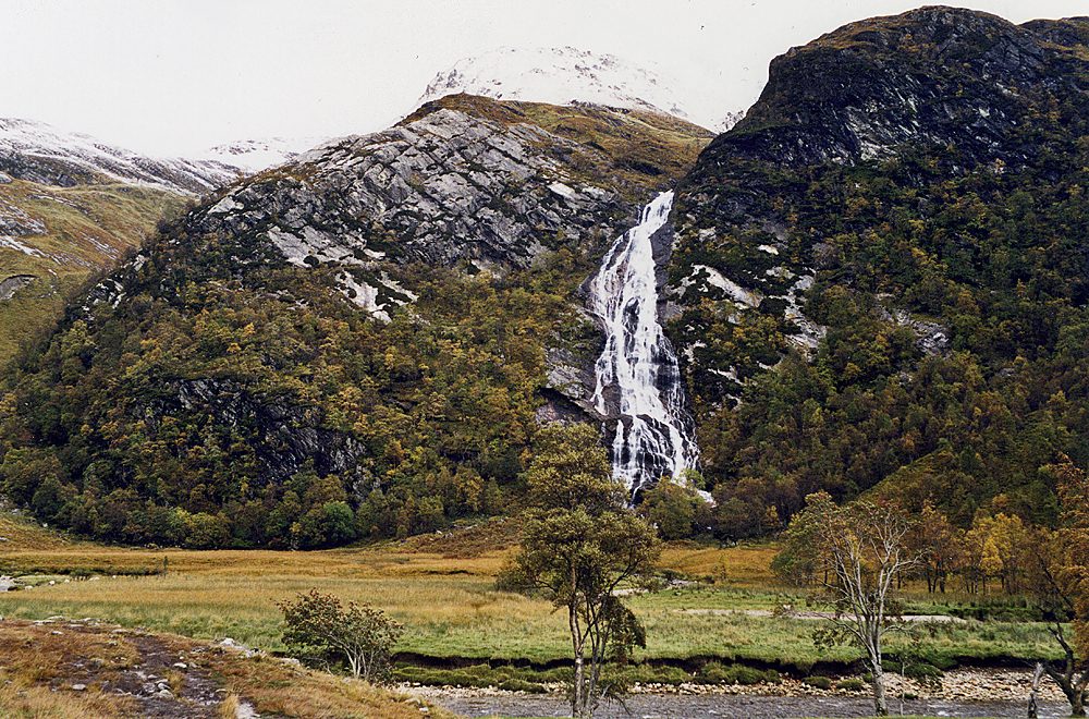
The walk starts from the car park at the very end of the road up Glen Nevis. The path heads into birch woods and soon becomes rough and rocky, cut into the side of the gorge in places, with the Water of Nevis crashing over boulders far below. After a rocky climb with steps and a handrail it reaches the top of the gorge, and the glen opens out into a flat green meadow. Steall Falls are straight ahead, pouring down the far side of the glen. The path continues to a bend by the river, the best place to see them, and the return is the same way.
It is 3.2 km with 122 m of ascent; allow about 1 hour. The grade is Easy: short, but on a rough path with steep drops beside it.
Good footwear and care are needed in the gorge, especially when wet. Steall Falls drop about 105 m and are at their best after rain. A side path leads to the wire bridge over the river: crossing it is optional and not part of this walk. The John Muir Trust looks after the land and the path.
Parking is free. A seasonal bus runs up the glen from Fort William as far as the Lower Falls.
Route drawn by Global Adventurer along OpenStreetMap paths (© OpenStreetMap contributors, ODbL), with figures worked out from it. Check the forecast and the ground on the day: paths change.
Good to know
- Steall Falls drop about 105 m, among the highest falls in Scotland
- The path through the Nevis Gorge is rough and rocky with steep drops
- The John Muir Trust looks after the land and the path
Getting there
Start: Upper Falls car park, Glen Nevis. 56.77746, -5.00078
Places to stay nearby
Rooms in and around Upper Falls car park: Booking.com → Expedia →
Affiliate links: if you book, Global Adventurer earns a small commission at no cost to you.
Paths change, and the weather decides the day. The line and figures come from OpenStreetMap and our own checks; take a map, check the forecast, and turn back if it isn't right.