Line © OpenStreetMap contributors (ODbL), checked by Global Adventurer.
The walk
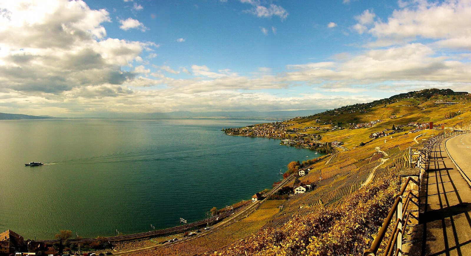
From Lutry station, climb through the vineyards to Châtelard and Grandvaux, high above the lake. The path then runs east along the terraces, held up by old stone walls, through Riex and above Epesses. It continues across the steep slopes of the Dézaley, among the best-known vineyards of the region, and down to Rivaz. A last stretch along the terraces leads to Saint-Saphorin, a village of narrow medieval lanes around its church. The lake and the French Alps across it fill the view the whole way.
It is 10.9 km one way with 318 m of ascent and 340 m of descent; allow about 3½ hours. The grade is Moderate: vineyard lanes and paths, with short, steep climbs and descents.
Lavaux has been a UNESCO World Heritage site since 2007. The lanes are used by growers' vehicles, and the vines are private: stay on the paths, especially at harvest time in September and October. There is little shade on hot days.
Trains on the lakeside line between Lausanne and Vevey stop at Lutry, Cully, Epesses, Rivaz and Saint-Saphorin, so any part of the walk can be done alone.
Route drawn by Global Adventurer along OpenStreetMap paths (© OpenStreetMap contributors, ODbL), with figures worked out from it. Check the forecast and the ground on the day: paths change.
Good to know
- Lavaux's terraced vineyards above Lake Geneva have been a UNESCO World Heritage site since 2007; at about 800 hectares they are the largest continuous vineyard area in Switzerland
- Up through the vineyards to Grandvaux, then along the terraces by Riex, Epesses, the Dézaley and Rivaz to Saint-Saphorin, with its narrow medieval lanes
- Trains on the lakeside line stop at Lutry, Cully, Epesses, Rivaz and Saint-Saphorin, so any part of it can be walked
Getting there
Start: Lutry station. 46.50389, 6.69026
Places to stay nearby
Rooms in and around Lake Geneva and Jura: Booking.com → Expedia →
Affiliate links: if you book, Global Adventurer earns a small commission at no cost to you.
Paths change, and the weather decides the day. The line and figures come from OpenStreetMap and our own checks; take a map, check the forecast, and turn back if it isn't right.