Line © OpenStreetMap contributors (ODbL), checked by Global Adventurer.
The walk
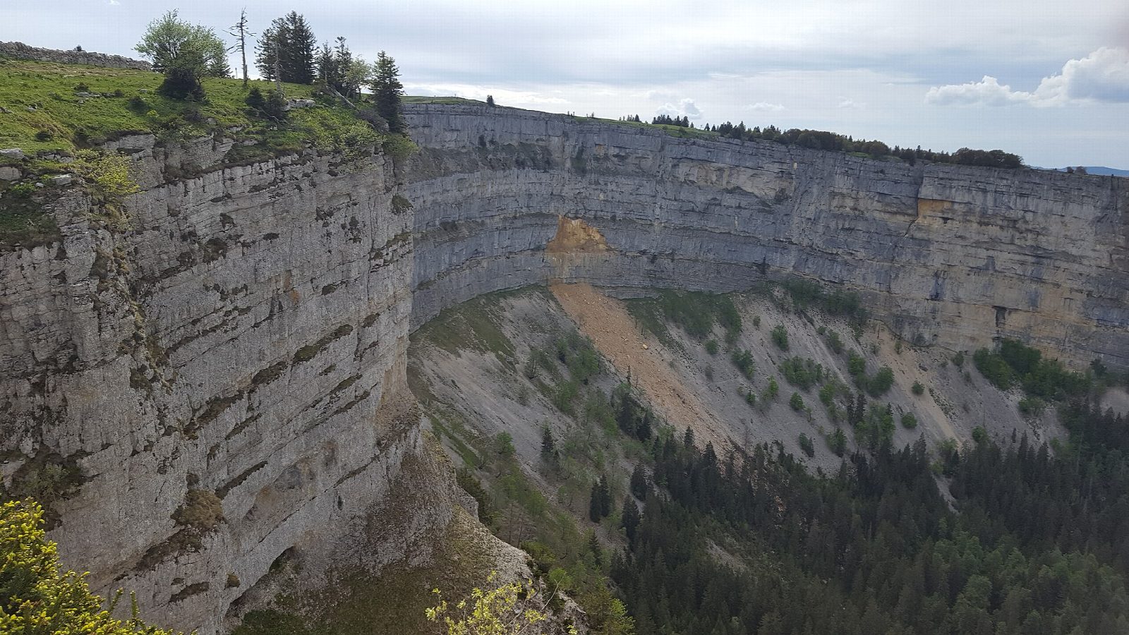
From Noiraigue station, walk south out of the village and up through woods and pasture to the Ferme Robert, an old farm inn at the foot of the Creux du Van. The path climbs through forest to the top of the cirque and over the Soliat, about 1,463 m, the highest point. Then it follows the rim of the amphitheatre, about 1.4 km across with cliffs some 160 m high. At its northern end the Sentier des 14 Contours zigzags down the slope to the woods above Noiraigue and back to the station.
It is 11.8 km round with 729 m of ascent; allow about 5½ hours. The grade is Moderate: woodland paths and pasture with steady climbs and a steep descent.
The cliff edge is unfenced in places: keep well back, especially with children and in fog. Ibex and chamois are often seen near the rim early and late in the day. Cattle graze the high pastures in summer.
Noiraigue is on the railway from Neuchâtel to the Val-de-Travers, with a small car park by the station.
Route drawn by Global Adventurer along OpenStreetMap paths (© OpenStreetMap contributors, ODbL), with figures worked out from it. Check the forecast and the ground on the day: paths change.
Good to know
- A rock amphitheatre in the Jura, about 1.4 km across with cliffs some 160 m high; the Soliat, about 1,463 m, stands on its rim
- Ibex and chamois are often seen near the rim early and late in the day
- The way back to Noiraigue goes down the Sentier des 14 Contours, a path of fourteen hairpins
- Noiraigue is on the railway from Neuchâtel to the Val-de-Travers
Summits on the way
- Le Soliat 1,465 m
Getting there
Start: Noiraigue station. 46.95494, 6.72182
By train: Noiraigue station is 0.0 km from the start.
Places to stay nearby
Rooms in and around Noiraigue: Booking.com → Expedia →
Affiliate links: if you book, Global Adventurer earns a small commission at no cost to you.
Paths change, and the weather decides the day. The line and figures come from OpenStreetMap and our own checks; take a map, check the forecast, and turn back if it isn't right.