Line © OpenStreetMap contributors (ODbL), checked by Global Adventurer.
The walk
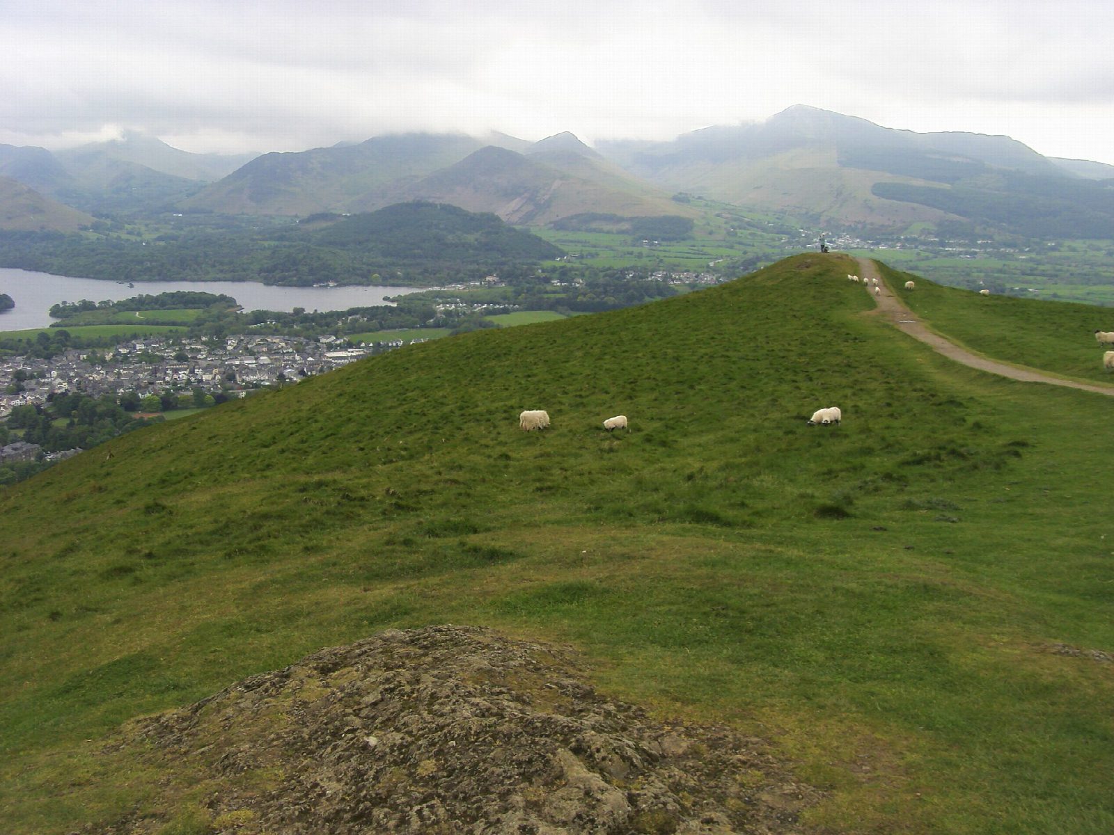
The walk starts from the car park opposite Keswick's old station. It follows the railway path east through the wooded gorge of the River Greta, over several of the old bridges, then leaves it for a lane to Brundholme and a track onto the east ridge of Latrigg. The ridge leads gently west to the summit and the viewpoint above Keswick, Derwent Water and the Newlands fells. The descent goes by a bridleway through Gale Ghyll Woods and over the A66 bridge into Spooney Green Lane, which returns to the start.
It is 8.2 km with 282 m of ascent; allow about 2¾ hours. The grade is Easy: one steady climb on good paths.
The railway path is surfaced and shared with cyclists; it was rebuilt after the floods of Storm Desmond in 2015. The climb onto Latrigg is gentle and on good paths, but the grass can be slippery. Many sheep graze the fell, so keep dogs on leads, and the bridleway down through the woods can be muddy.
The car park charges a fee.
Route drawn by Global Adventurer along OpenStreetMap paths (© OpenStreetMap contributors, ODbL), with figures worked out from it. Check the forecast and the ground on the day: paths change.
Good to know
- Out along the old Keswick to Penrith railway in the Greta gorge, back over Latrigg
- Latrigg is the little fell above Keswick, with a view over the town to Derwent Water
- The railway path was rebuilt after the floods of Storm Desmond in 2015
Summits on the way
- Latrigg 369 m
Getting there
Start: Keswick old station car park · Pay and display. 54.60402, -3.13039
Places to stay nearby
Rooms in and around Aspatria: Booking.com → Expedia →
Affiliate links: if you book, Global Adventurer earns a small commission at no cost to you.
Paths change, and the weather decides the day. The line and figures come from OpenStreetMap and our own checks; take a map, check the forecast, and turn back if it isn't right.
